|
[ UrbanRail.Net ] [ Europe ] [ Americas ] [ Asia ] [ Africa ] [ Oceania ] [ News ] [ Books ] [ Links ] [ Blog ] [ Shop ] |
|
VANCOUVER
|
| British Columbia . Canada |
|
System
|
|||||
|
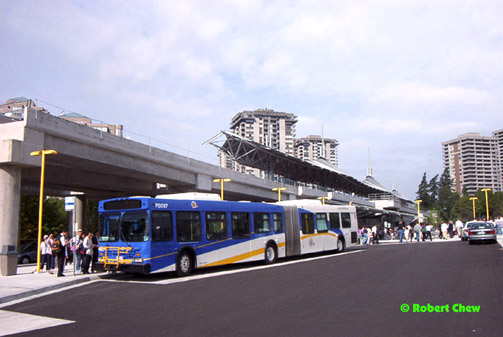
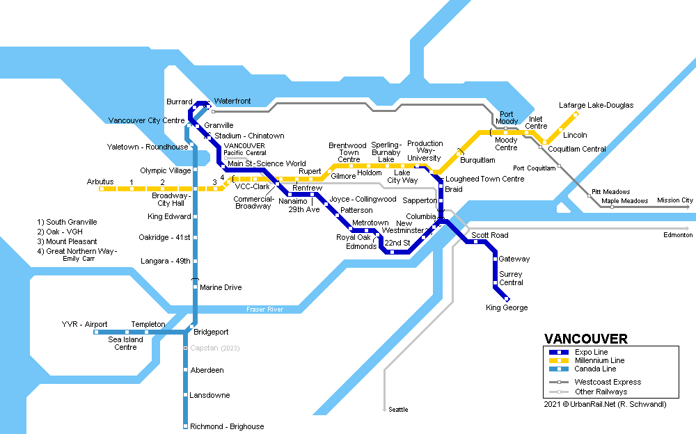
Vancouver (British Columbia, Canada) is situated on the west coast not too far from the U.S. border. The metropolitan area has some 3 million inhabitants. Vancouver hosted the 1986 World Expo and the 2010 Winter Olympics. The Vancouver Metro, called the SkyTrain, is an automated metro system, similar to the VAL systems of Lille and Toulouse. Since August 2009, there have actually been two systems, incompatible with each other, the older Expo/Millennium Lines and the newer Canada Line. Apart from SkyTrain there is the West Coast Express, a typical North American commuter railway which only operates into Vancouver in the mornings and from Vancouver in the evenings (5 trains each direction).
|
|||||
| Expo Line | Millennium Line | ||||
|
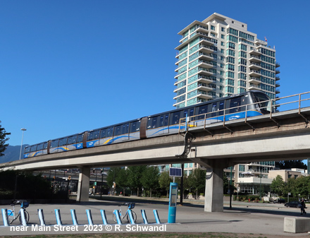
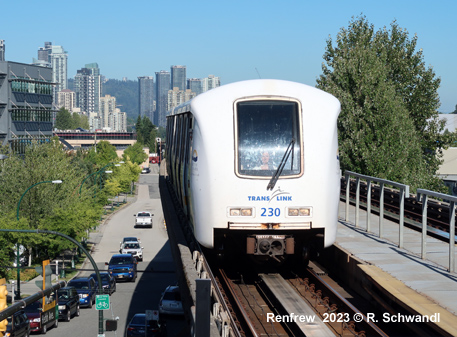
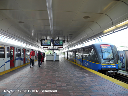
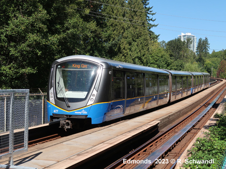
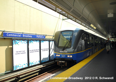
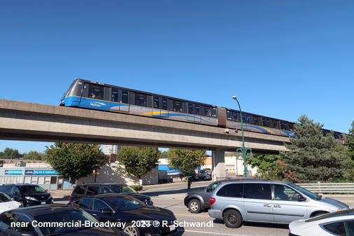
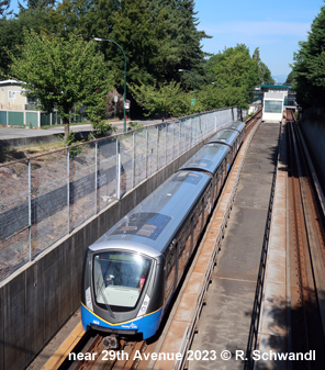
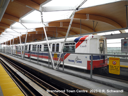
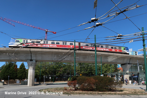
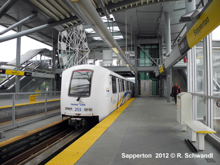
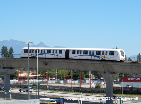
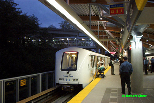
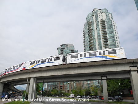
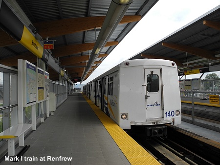
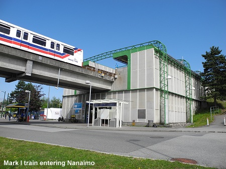
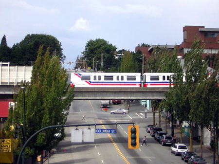
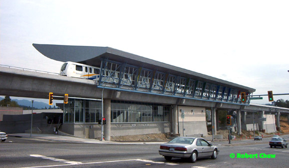
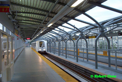
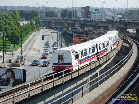
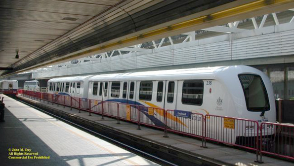
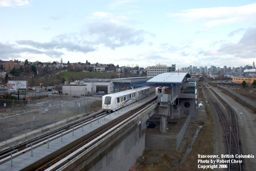
From 2002 until 2016, the Expo & Millennium Lines both used to start in downtown Vancouver and serve the southeastern neighborhoods of the metropolitan area. In anticipation of the opening of a new branch from Lougheed o Coquitlam (previously known as the Evergreen Line), the service was restructured on 22 Oct 2016, with only the Expo Line now running from Waterfront towards the southeast, before splitting into two branches at Columbia; the Millennium Line now operates from VVC-Clark via Lougheed Town Centre to Lafarge Lake-Douglas in Coquitlam. SkyTrain platforms are 80 m long, which allows 6-car trains; the busier Expo Line mostly operates with 4 or 6-car mark I trains or 4-car mark II or III trains, while on the Millennium Line 2-car trains of the mark II type are common. The average station distance is 730 m in the city centre and 1750 m in other areas. All stations now have elevators, after Granville was retrofitted with one in 2006. The Expo Line is 36.4 km (including a 1.3 km former railway tunnel in downtown Vancouver with Burrard and Granville stations plus two short tunnels around Columbia station in New Westminster). Production Way-University and Lougheed Town Centre stations are shared with the Millennium Line. A 16 km extension beyond King George in Surrey to Langley is under construction. [Project Website] The Millennium Line is 25.5 km and runs partly in a trench, partly at grade, but mostly elevated; there is also a 2.1 km tunnel on the 11 km branch to Coquitlam which was originally known as the 'Evergreen Line'. A 6 km western extension is under construction from VCC-Clark station along Broadway to Arbutus Street in the Vancouver Westside; it may later be extended by another 6 km to University of British Columbia. [Project Website] 03
Jan 1986: Waterfront - New Westminster full revenue service after
weekend trial service since 11 Dec 1985 (21.4 km)
|
|||||
|
|
|||||
| Canada Line | |||||
|
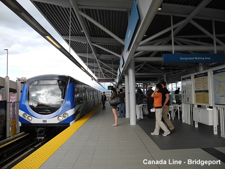
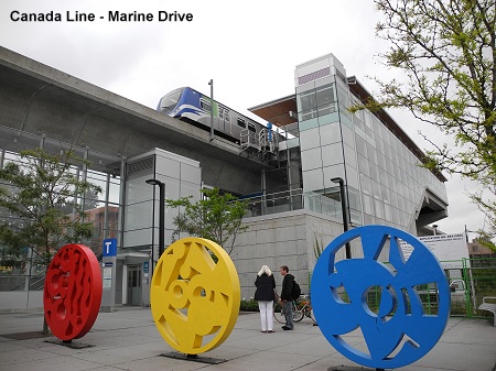
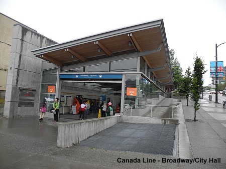
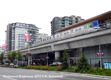
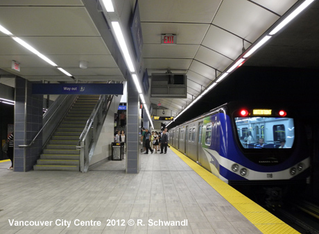
Canada Line - initially referred to as the Richmond-Airport-Vancouver line (RAV), it began construction in late 2005. It opened on 17 August 2009, a few months ahead of the 2010 Winter Olympics. The line is 19.5 km long, and extends from Waterfront south along Granville and Cambie Streets, over the North Arm of the Fraser River; it then splits into two branches, one going to Richmond and the other to Vancouver International Airport (YVR). The line is underground from Waterfront to Marine Drive, while the rest is elevated to Richmond and partly at grade to the airport. Service is provided by driverless 2-car trainsets delivered by Rotem; they are only 41 m long,but 3 m wide. 17 Aug 2009:
Waterfront - YVR-Airport/Richmond-Brighouse (19.5 km)
|
|||||
|
|
|||||
|
Photos
|
|||||
|
|
|||||
|
Links
|
|||||
|
incl. Rapid Transit Projects Vancouver Skytrain at Wikipedia Canada Line at Wikipedia NYC-Subway-Resources - Vancouver Page Read your webmaster's personal impressions of the Vancouver SkyTrain system (July 2012)
|
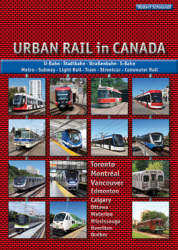
URBAN RAIL in CANADA – Metro · Subway · Light Rail · Tram · Streetcar · Commuter Rail Vancouver · Calgary · Edmonton · Waterloo/Kitchener · Hamilton · Mississauga · Toronto · Ottawa · Montréal · Québec Text deutsch
& English |
 |
|||
| Videos | |||||
|
Canada
Line Ride - Waterfront > YVR Airport
|
|||||
|
Canada
Line Ride - Richmond-Brighouse > Waterfront
|
|||||
| Expo Line - Waterfront > Production Way-University | |||||
| Millenium Line - Lafarge Lake-Douglas > VCC-Clark | |||||
| Older Photos | |||||
|
|
|||||
|
|
|||||
2007 © Robert Schwandl (UrbanRail.Net)