|
[ UrbanRail.Net ] [ Europe ] [ Americas ] [ Asia ] [ Africa ] [ Oceania ] [ News ] [ Books ] [ Links ] |
|
KYIV
|
| Ukraine |
Click here for full map including tram and railway lines!
Kyiv
![]()
| KYIV (KIEV) |
|
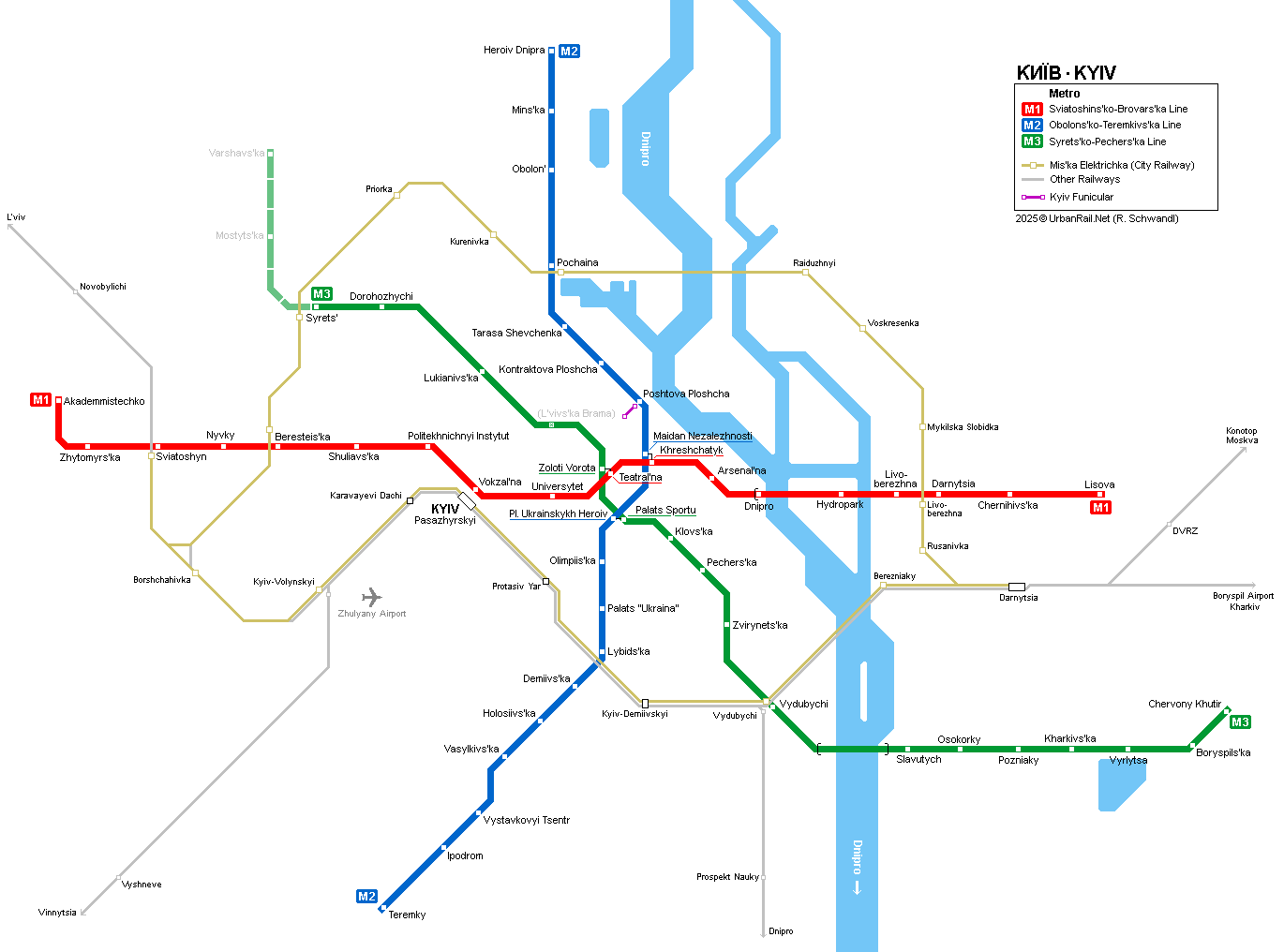
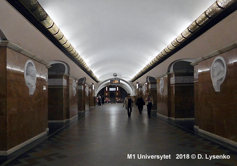
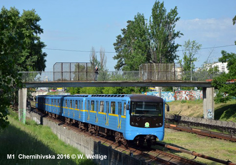
The capital of Ukraine, is situated on the river Dnipro and has about 2.6 million inhabitants. Its metro system is a typical ex-Soviet three line system (total length 67.6 km in Nov 2013) with all lines meeting in the city centre to form a triangle. Older stations in the city centre were built in the underground palace style similar to Moscow's metro. The network is entirely underground on the right bank of the river Dnipro (Dnieper) with two bridge-crossings of the river and one at-grade stretch on Line 1 on the left bank. Apart from the Metro there are two rapid tram lines, with the first operating from the Railway Station (Vokzal'na) to the western suburbs (Kil'tseva Doroha, 9.1 km, 1977). Running in the median of a major road, after 20 years of operation, the line was upgraded in 2009/2010. A branch to Mikhailsvs'ka Borschahivska, which has a more light rail type alignment, was added in 1984. A second 6.7 km rapid tram line is in service in the district of Troeschyna in the north of the left bank now connecting Troeschina-2, a new station on the city ring railway, with the standard tram system at Miloslavs'ka.
|
| Lines & History |
| .. |
| Line M1: Chervona Liniya - Red Line - 22.8 km, 18 stations |
|
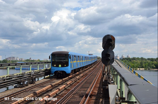
In 1960 the first part of the first line (Sviatoshyns'ko-Brovars'ka) opened between Vokzal'na (Central Station) and Dnipro. The latter station with side platforms is situated on the bridge over the motorway along the bank of the Dnieper river. After this station, eastbound, the line crosses the river on a dedicated metro bridge and continues on the surface to the eastern terminus. 6 Nov 1960:
Vokzal'na
- Dnipro (5.2
km) Although one more station at the western end had been planned to create a transfer to Novobilychi commuter rail station, no extensions of this line are expected in the near future.
|
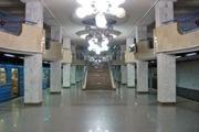
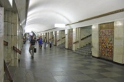
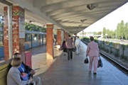
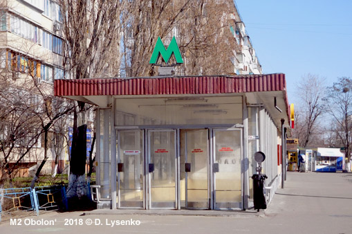
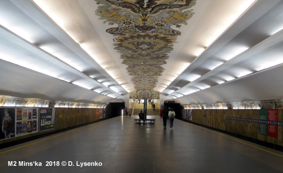
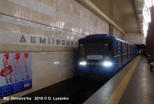
| Line M2: Synya liniya - Blue Line - 20.9 km, 18 stations |
|
The second line (Kurenivs'ko-Chervonoarmiys'ka Line) was opened in 1976 between Ploscha Kalinina (later Ploscha Zhovtnevoi Revoliutsii and now Maidan Nezalezhnosti, transfer to Khreschatyk station) and Chervona Ploscha (now Kontraktova Ploscha). Between 1980 and 1984 the line was extended at both ends, with the first section of a longer southern extension finally being brought into service in 2010: 17
Dec 1976: Ploscha Kalinina (now Maidan Nezalezhnosti) -
Chervona Ploscha (now Kontraktova Ploscha) (2.3 km) |
|
More
M2 photos |
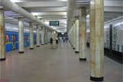
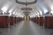
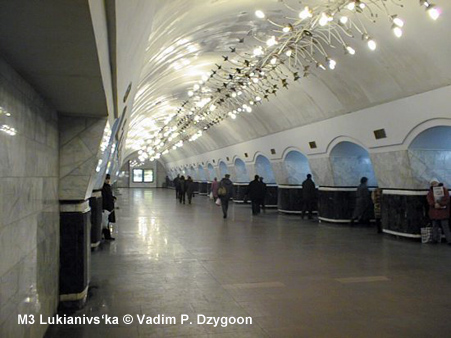
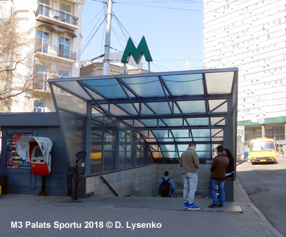
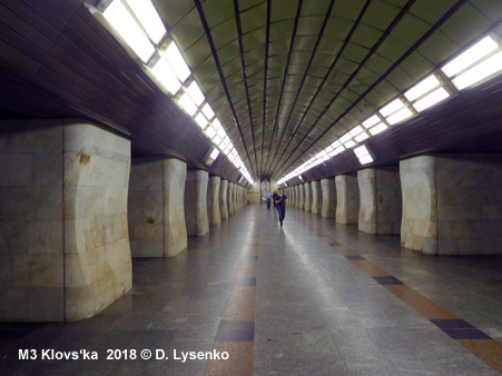
| Line M3: Zelena liniya - Green Line - 23.9 km, 16 stations |
|
The third line (Syrets'ko-Pechers'ka) also began in the city centre in 1989 and this line has been growing towards the south-east crossing the river on a bridge covered in an aluminium shelter: 31
Dec 1989: Zoloti Vorota - Mechnikova (now Klovs'ka) (1.9
km) There are two built in draft stations on this line, L'vivs'ka Brama and Telychka. The opening of L'vivs'ka Brama depends on the finishing of replanning and reconstruction of L'vivs'ka Sq. above the station to know the location of station entrances to build escalator tunnels toward them. Telychka station between Vydubychi and Slavutych on the right bank of the Dnieper River will be opened later, when the industrial zone around it will be transformed into large residential and an office complex.
|
|
More
M3 photos |
|
Projects |
|
The Green Line is being extended towards the northwest to reach Mostyts'ka and Prospekt Pravdi with one more depot for this line (2021). Later a fill-in station called L'vivs'ka Brama station may open between Lukianivs'ka and Zoloti Vorota. The first five stations of the fourth line, the Podil's'ko-Voskresens'ka, from Tarasa Shevchenka east to Raduzhna were once planned to open in 2017, but the real completion date is now in the distant future: Since late 2004, a new two-level motorway/metro Podil's'kyi bridge is being built over the Dnieper River to connect Central railway station (Vokzal'na) with residential zones on the north of the left-bank part of Kyiv. The line using this bridge, will intersect with all existing lines (Line 1 at Vokzal'naya, Line 3 at Lukyanivs'ka, Line 2 at Tarasa Shevchenka). Click here for a geographical map with projects in 2010 (by Alex Riabov) |
| Links |
|
KYIV METRO (Official Page) Kyiv Pastrans (Tram Operator) Easyway Kyiv - Journey Planner Kyiv Metro at Wikipedia Kiev Metro Page by Vadim P.Dzygoon Metrosoyuza by Peter Donn includes nice station pictures Mir metro/Metroworld - Kyiv by Dmitry Aksenov Muzey Metro (incl. many historic photos) Scanned map from my collection 1997 (282 K) Mikhail Barashkov's Page about Kyiv's second fast tram Kyiv Tram at Wikipedia
|
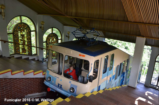
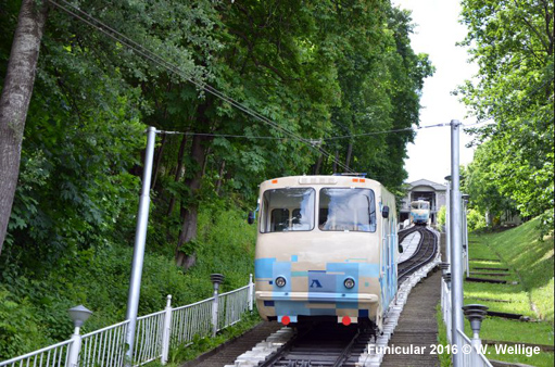
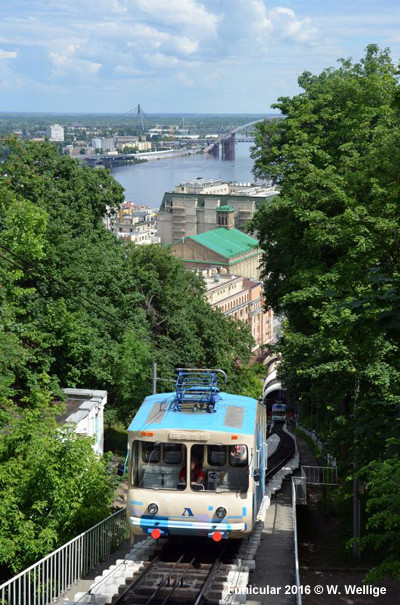
| Funicular |
|
|
| Metro Book |
|
Kyivskiy Metropoliten by Kostj Kozlov (including English summary)
|
| Metro Museum |
|
Open on Mondays, Fridays - 10:00-13:00, on Wednesdays - 14:00-17:00 Address: Prospekt Peremogy 35, Tel 238-4494 |
| Photos |
Changed station names:
| Year | Earlier name | Later name(s) |
|
1977 |
Ploscha
Kalinina |
Ploscha
Zhovtnevoi Revoliutsii Kontraktova Ploscha Palats "Ukraina" Lybids'ka Chernihivs'ka Teatral'na Klovs'ka Lisova Maidan Nezalezhnosti Obolon' Shuliavs'ka Beresteis'ka Olimpiys'ka Pochaina Zvirynets'ka Ploshcha Ukrainskykh Heroiv |
Transliteration of Ukrainian station names from Cyrillic into Latin spelling following the official table published by the Ukrainian Parliament in 1996 (also at http://www.rada.kiev.ua/translit.htm)
2004 © UrbanRail.Net
