|
[ UrbanRail.Net ] [ Europe ] [ Americas ] [ Asia ] [ Africa ] [ Oceania ] [ News ] [ Books ] [ Links ] |
|
HELSINKI
|
| Finland |
|
[ UrbanRail.Net ] [ Europe ] [ Americas ] [ Asia ] [ Africa ] [ Oceania ] [ News ] [ Books ] [ Links ] |
|
HELSINKI
|
| Finland |
| METRO | |||
|
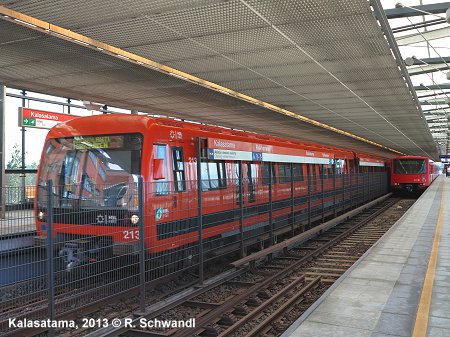
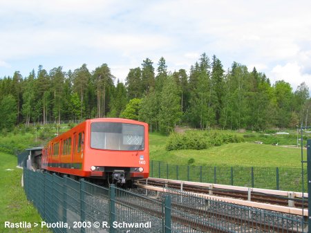
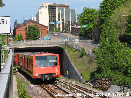
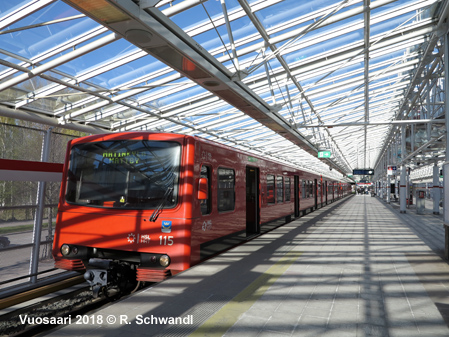
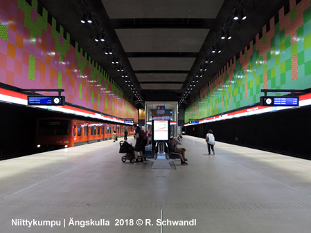
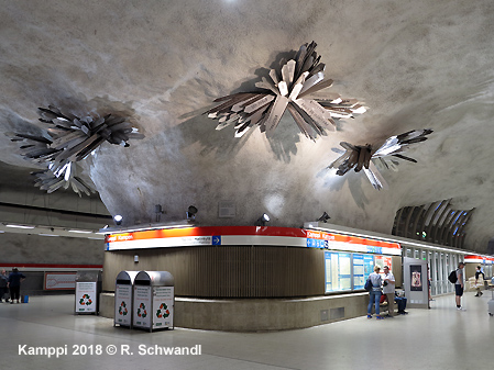
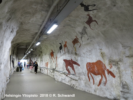
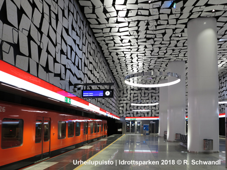
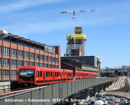
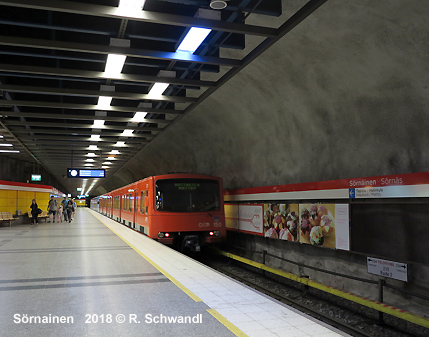
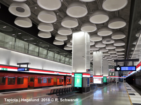
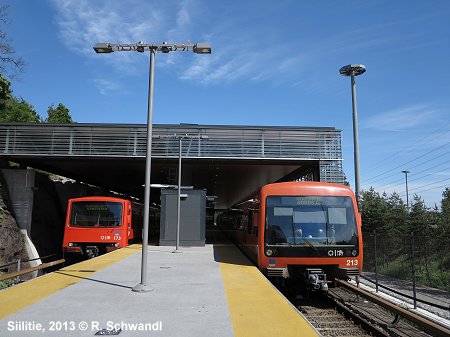
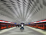
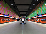
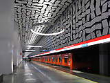
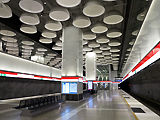
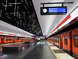
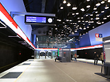
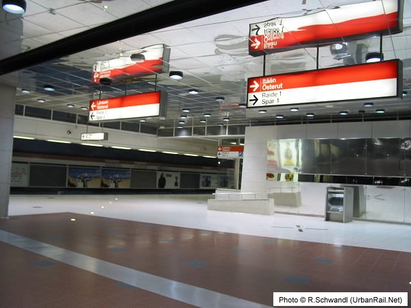
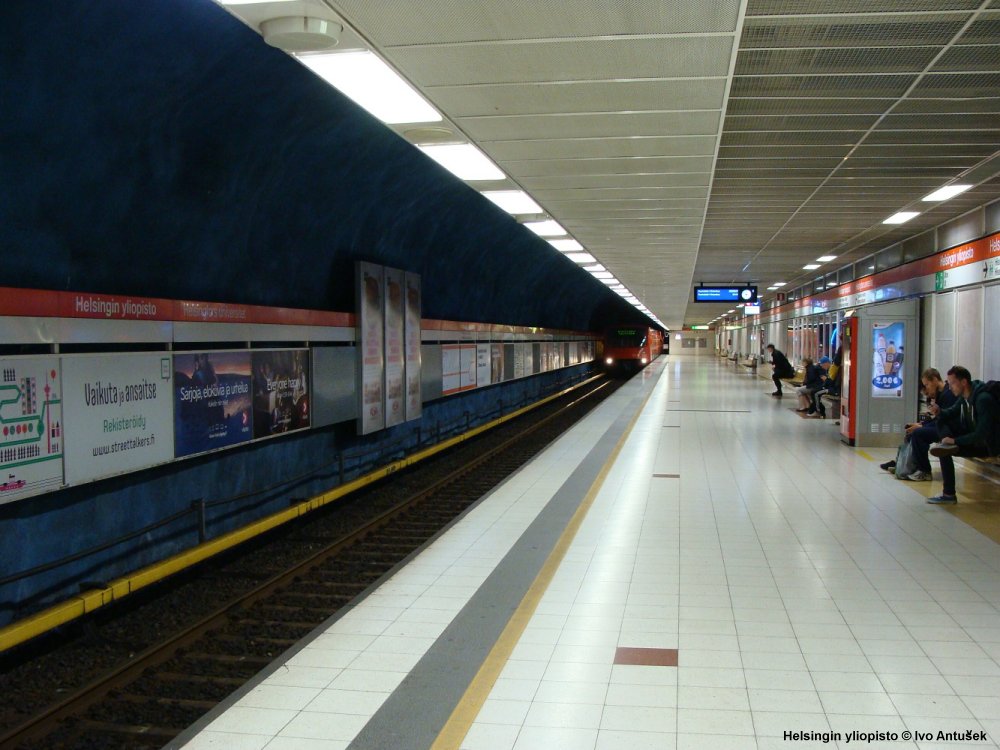
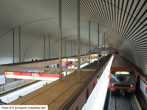
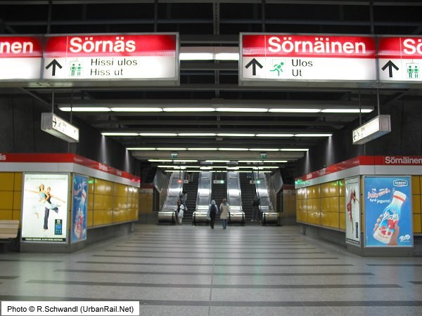
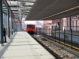
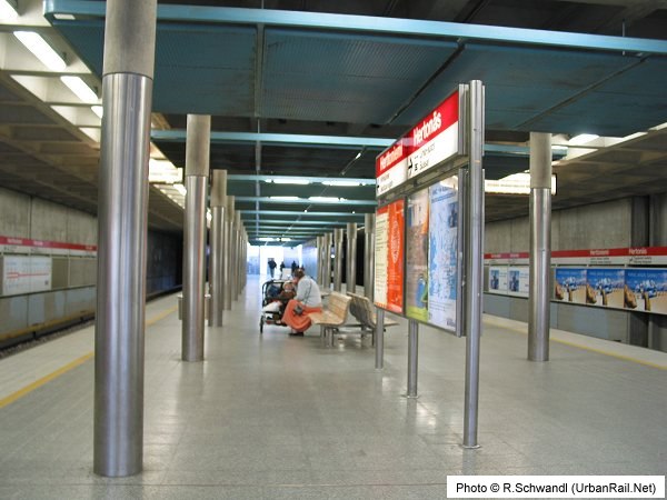
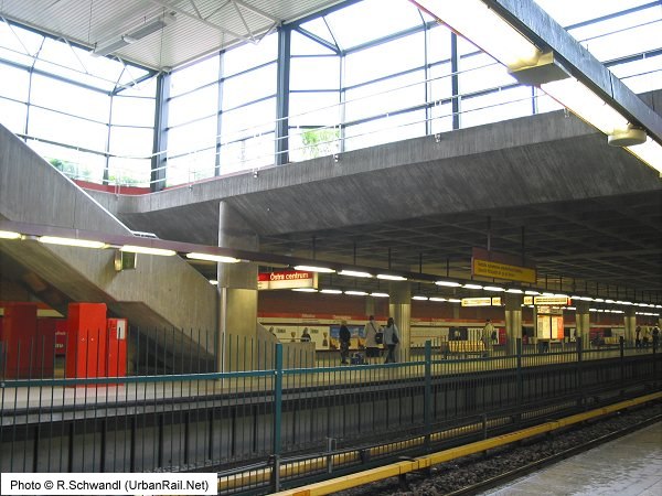
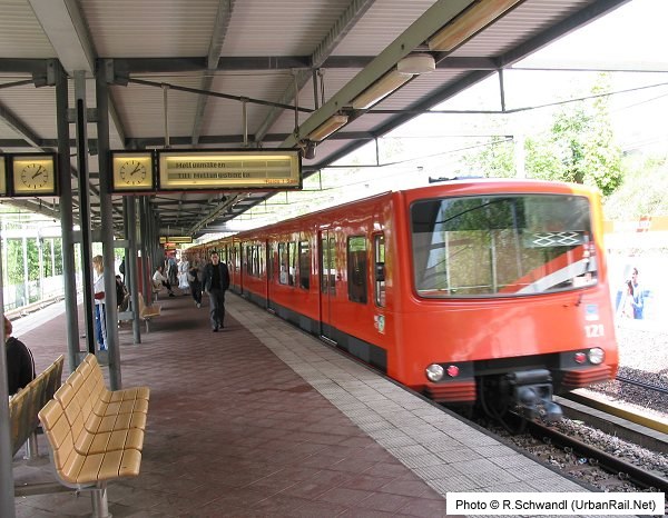
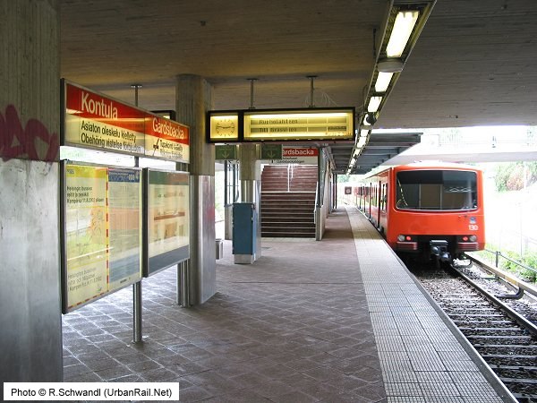
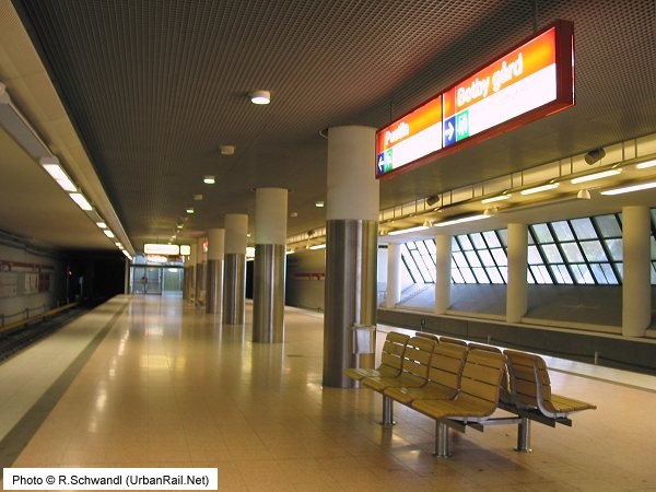
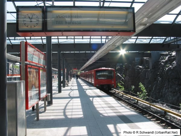
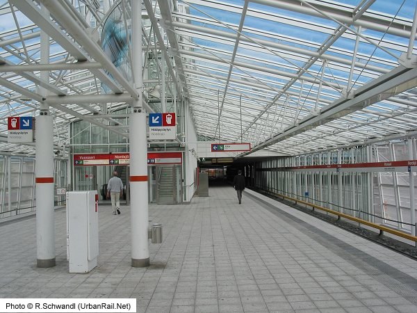
The original Helsinki Metro linked the city centre to the eastern suburbs (21 km - 17 stations, two branches). 4.9 km are in a tunnel through the city centre. The bigger part of the line (Kamppi - Itäkeskus) was opened between 1982 and 1983, in 1986 the line was extended to Kontula and in 1989 further out to Mellunmäki. In the city centre one more station was added to reach Ruoholahti. The branch from Itäkeskus (4 km) east to Vuosaari opened in Sept. 1998. This stretch runs underground from Itäkeskus to Puotila and further until it reaches Vartiokylänlahti Bay which is crossed on a bridge. From there the line continues in a cutting. The underground stations were equipped as air raid shelters with an overall capacity for 21,000 people. Underground stations in the city centre are built in deep rock, three stations along the eastern section (Herttoniemi, Itäkeskus, Puotila) lie just below ground, with an entrance building on surface level. The remaining stations are on the surface and are generally covered to protect passengers during harsh winters. See all stations below > Eventually in November 2017 and with several years of delays, a western fully underground extension, the so-called Länsimetro/Västmetron, to the neighbouring city of Espoo was opened after construction had started in late 2009. The new section is 14 km long and includes eight stations. While this extension was initially designed for automatic driverless operation, the existing line was supposed to be retrofitted with platform screen doors and an automatic control system (Trainguard MT) supplied by Siemens, but the project was cancelled in 2015. From
Nov 2017, the Metro was operated by two lines, offering a train every
2.5 min during rush hour and every 3-4 min off-peak between Tapiola
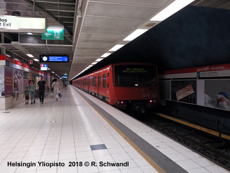
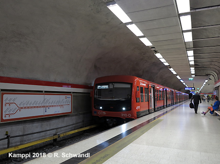
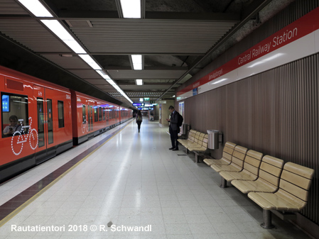
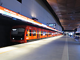
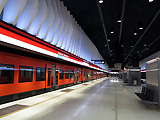
and Itakäskus: Travelling time between Ruoholahti and Mellunmäki or Vuosaari is 21-22 minutes. All stations (17 underground, 8 above ground) are fully accessible. Station platforms are 135 m long. The Metro has 1522 mm gauge (quite the same as the national rail network - 1524 mm) and third rail power supply (750V dc). The Metro control centre is situated at Hakaniemi station. There are three different types of train in service: 1) the original M100-series (1977-1984, built by Valmet / Str�mberg, Finland); 2) the M200-series (2000-2001, built by Bombardier); 3) the M300-series from CAF. A 2-car unit is 44.2 m long, trains are 3.2 m wide. Each car has 3 doors on either side. A full length train consists of 6 cars, although 4-car trains are normally in service. As of Dec 2022, the total length of the Metro system is 42 km (of which some 27.5 km is in tunnel). |
|||
|
|||
|
Metro History |
|||
|
01
June 1982: Hakaniemi - It�keskus (rush hour traffic)
|
|
||
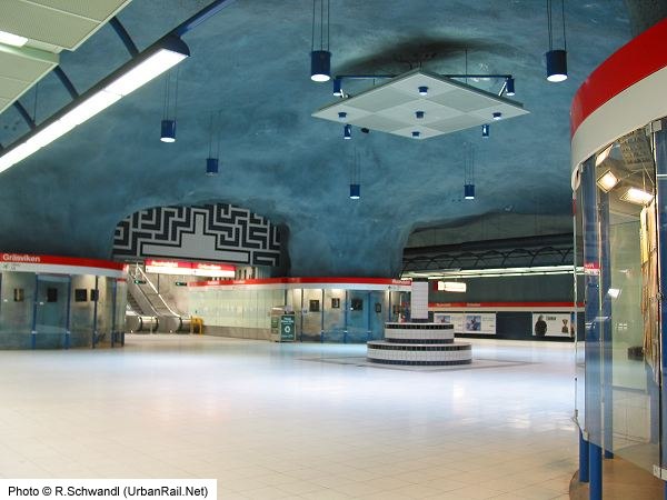
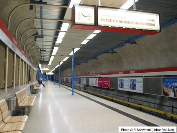
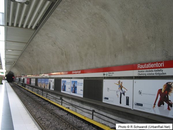
| Helsinki Metro Stations | |||
 |
 |
 |
|
| Matinkylä | Mattby xx km > | Niittykumpu | Ängskulla xx km > | Urheilupuisto | Idrottsparken xx km > | Tapiola | Hagalund xx km > |
 |
 |
 |
 |
| Aalto-yliopisto | Aalto-universitetet xx km > | Keilaniemi | Kägeludden xx km > | Koivusaari | Björkholmen | Lauttasaari | Drumsö xx km > |
 |
 |
 |
|
| Ruoholahti | Gräsviken 1.2km > | Kamppi | Kampen 0.5km > | Rautatientori | Järnvägstorget 0.6km > | Helsingin yliopisto* | Helsingfors universitet* 0.9km > |
 |
 |
 |
 |
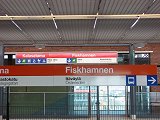
| Hakaniemi | Hagnäs 0.9km > | Sörnäinen | Sörnäs 1.0km > | Kalasatama | Fiskehamnen | Kalasatama | Fiskehamnen 1.9km > |
 |
 |
 |
 |
| Kulosaari | Brändö 1.4km > | Herttoniemi | Hertonäs 1.4km > | Siilitie | Igelkottsvägen 2.0km > | Itäkeskus | Östra centrum 1.9km/1.0km > |
 |
 |
 |
|
|
Northern
branch:
|
1.9km > Myllypuro | Kvarnbäcken 1.4km > | Kontula | Gårdsbacka 1.6km > | Mellunmäki | Mellungsbacka |
 |
 |
 |
|
|
Eastern
branch:
|
1.0km > Puotila | Botby gård 1.9km > | Rastila | Rastböle 1.2km > | Vuosaari | Nordsjö |
| *20-01-2015: Kaisaniemi | Kajsaniemi renamed Helsingin yliopisto | Helsingfors universitet | |||
| All | |||
|
View our Länsimetro gallery!! |
|||
|
All photographs © R. Schwandl (UrbanRail.Net) except Kalasatama 2007 © Jouko Ketola
|
|||
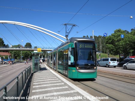
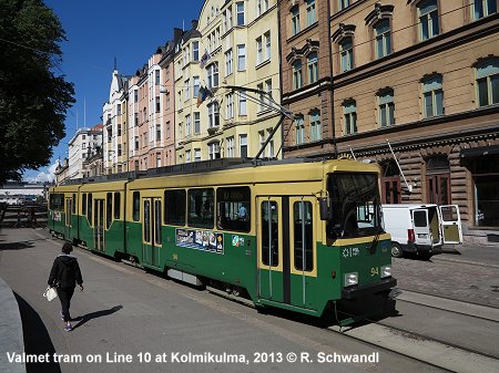
| TRAM | |||
|
A semicircular light rail line (Raide-Jokeri) was opened in 2023 to connect Espoo (Keilaniemi) in the west with Itäkeskus in the east (25 km) [Project Website] The Vantaa Light Rail started construction in mid-2025 - the line will link Mellunmäki metro station with the airport via Tikkurila station [Project Website]
|
|||
|
|
|||
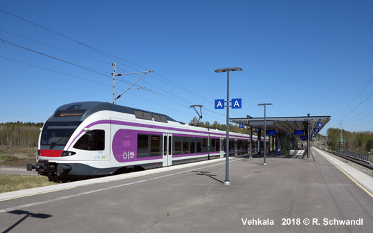
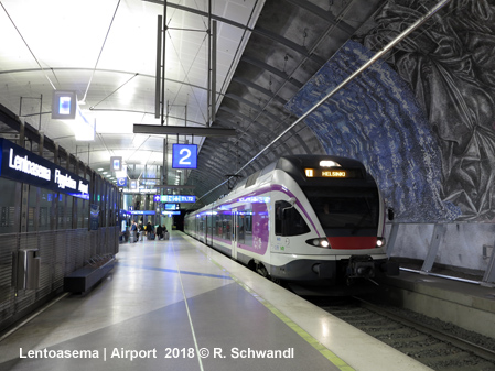
| SUBURBAN RAIL | |||
|
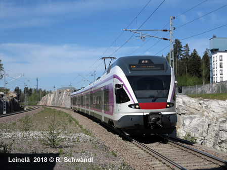
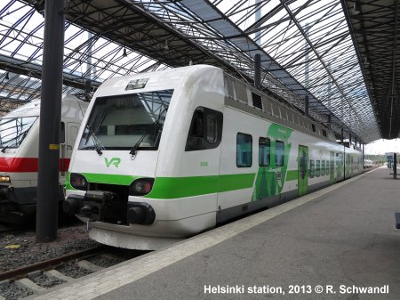
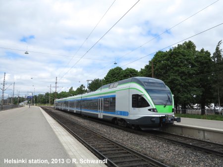
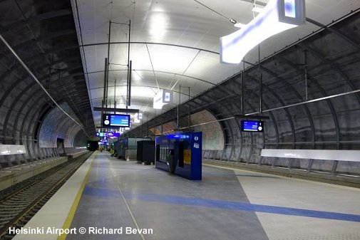
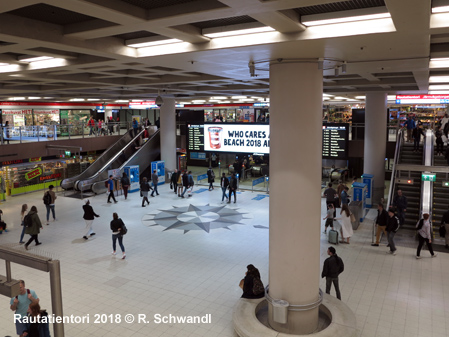
From Helsinki's Central Railway Station (metro's Rautatientori/Järnvägstorget station), three commuter rail lines operate every 10-20 minutes providing local and express services. The lines to Tikkurila/Kerava/Riihimäki and to Lepp�vaara/Espoo/Karjaa follow mainline tracks, with a dedicated pair of suburban tracks available to Leppävaara and Kerava. The 15 km line to Vantaankoski (formerly M service) runs on exclusive tracks; this branch was extended to the Airport, forming a loop that joins the northeastern main line at Hiekkaharju. Opened on 1 July 2015, the "Ring Rail Line" is mostly served every 10 minutes in both directions (I+P services).
|
|||
|
|
|||
| Links | |||
|
Kaupunkiliikenne/Metropolitan Area Transport (Tram & Metro operator) HSL - Transport in Helsinki Metropolitan Area (Tickets, Fares, etc.) Länsimetro (Western extension - official site) VR (Finnish Railways - Commuter Trains) Helsinki Metro at Wikipedia Virtual tour of the entire metro system with 360° station panoramas (incl. 2017 stations) Helsinki Public Transport Maps by Elmo Allén
Your webmaster's personal impressions on the different urban rail systems in Helsinki (16 June 2013) and additional observations (14 May 2018)
|
|||
|
|||
2004 © UrbanRail.Net by Robert Schwandl.