|
[ UrbanRail.Net ] [ Europe ] [ Americas ] [ Asia ] [ Africa ] [ Oceania ] [ News ] [ Books ] [ Links ] |
|
HANNOVER
|
| Niedersachsen| Lower Saxony . Germany |
|
[ UrbanRail.Net ] [ Europe ] [ Americas ] [ Asia ] [ Africa ] [ Oceania ] [ News ] [ Books ] [ Links ] |
|
HANNOVER
|
| Niedersachsen| Lower Saxony . Germany |
| System & History | |||||
|
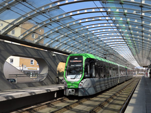
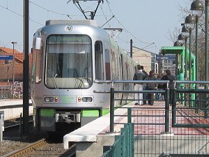
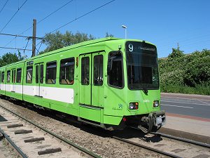
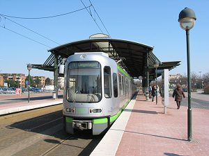
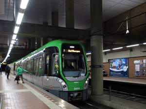
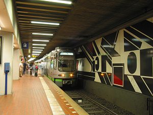
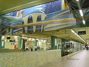
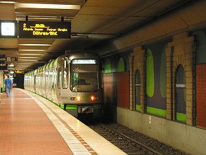
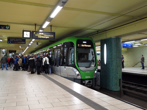
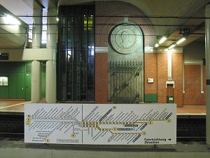
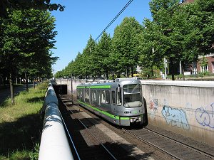
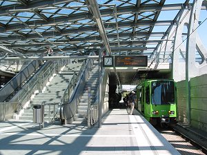
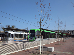
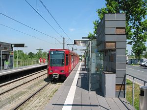
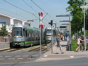
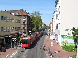
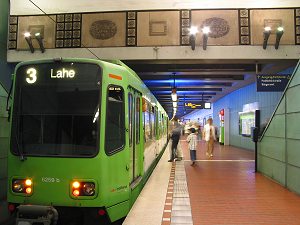
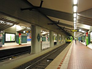
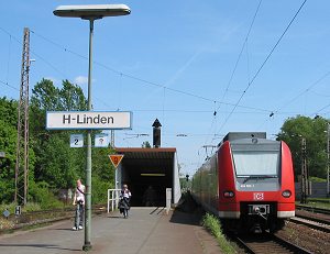
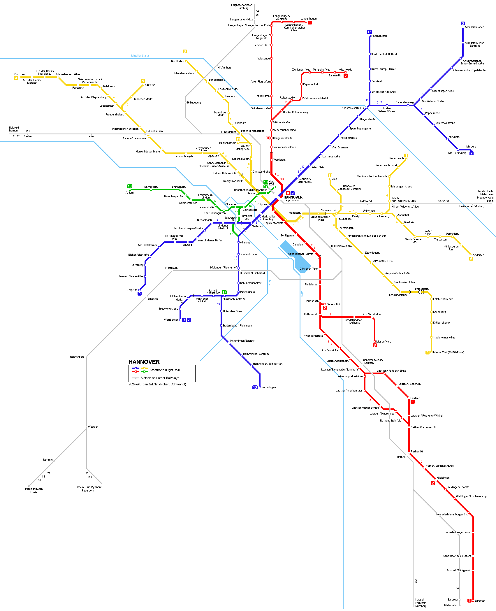
Hanover (Hannover) is the capital of the German state of Niedersachsen (Lower Saxony) and has approx. 500,000 inhabitants (more than a million in the Greater Hannover area). The city is known for its trade fairs and hosted the Expo2000. The Hannover Stadtbahn is, similar to the networks in Stuttgart, Frankfurt, the Rhine-Ruhr Area or Bielefeld, a system combining metro/subway and tramway features. Central sections are underground, whereas the rest is on street level, although mainly (75%) on a separate right-of-way with some level crossings. This kind of system gives a city of the size of Hanover an efficient metro-like system in the city centre, underground and thus totally independent, frequent through bundled routes and easily accessible through high platforms, a feature also growing among surface stations. The first underground section along Route A was opened in 1975 for south-western lines between Waterloo and Hauptbahnhof. In 1976 the eastern part followed to allow through trains towards Lahe. In June 2006, route A was extended from Lahe (now Paracelsusweg) to Altwarmbüchen (4.6 km) on a typical surface light rail alignment. This was followed by short branch from Paracelsusweg to Schierholzstraße (Misburg Nord) on 12 Dec 2010 (1.7 km), with a further 3-station extension opened from Schierholzstraße to Misburg on 14 Dec 2014 (1.5 km). Route B opened as a north-south cross city route in 1979 (Werderstraße - Kröpcke) and continued south in the following years (1981 - Schlägerstr., 1982 - Altenbekener Damm and further south on the surface). Route C began operation between Kröpcke and Steintor in 1984 and continued west in a tunnel as far as Königsworther Platz and further on the surface in 1985. The eastern branch from Aegidientorplatz to Braunschweiger Platz and further out on the surface opened in 1989. The northern branch from Steintor to Kopernikusstraße finally followed in 1993. An extension for Line 5 from Ostfeldstraße (Kirchrode) to Anderten opened on 15 Dec. 2002. Initially a fourth city tunnel for Route D was planned, but this won't be built in the near future. A southern feeder line for this route was built to provide access to the eastern entrance for the Expo2000. It reached its southern terminus at Messe/Ost (EXPO-Plaza) on 19 February 2000 and was connected to the tunnel section of Route C. The western section of Route D (Line 10) is a standard tramway line running on the surface also in the city centre. Apart from the central tunnel sections, two more stations are underground so far, Mühlenberg (now Mühlenberger Markt), on route A in the southwest (lines 3 and 7 - extended to Wettbergen in 1998), and on the new southern section of Route D Bemerode/Mitte (now Brabeckstraße), which is actually open above the tracks. The Hanover Stadtbahn network has a total length of 123 km long of which 19 km are in tunnels (with 19 underground stations). Transfer between lines is made very easy at Kröpcke, Aegidientorplatz and Hauptbahnhof (cross-platform). On the surface, many stops provide cross-platform interchange between the Stadtbahn and connecting bus lines. On 25 May 2017, the surface tram section between Hauptbahnhof and Aegidientorplatz (1 km) was permanently closed. Instead, since 18 Sept 2017, lines 10 & 17 have terminated at the eastern side of the railway station at Hauptbahnhof/ZOB (350m). 10 Dec 2023: Line 13 Wallensteinstraße – Hemmingen-Westerfeld (3.1 km) Just in time for the World Expo in the year 2000, Deutsche Bahn AG (DB) introduced an S-Bahn service for Hanover, with trains every 30 minutes on most lines.
|
|||||
| Photos | |||||
|
|
|||||
| Links | |||||
|
ÜSTRA (Stadtbahn Operator) - Official Page GVH (Greater Hannover Tariff Union) - Official Page Stadtbahn Hannover by Andreas Kowollik |
|||||
| Photos | |||||
|
|
|||||
| Books | |||||
|
Horst Moch: Straßenbahn in Hannover. - August 2004, Kenning, ISBN 3933613450 Heinrich Ganseforth, Peter Ruthenberg: Eine neue Stadtbahn für Hannover (Jasper Morrison) . - 1997, Mann, Berlin, ISBN 3786122482 NAHVERKEHR IN HANNOVER - Spezialheft des Straßenbahnmagazins (Public Transport in Hanover), GeraNova, 2000. Dieter Höltge: Straßen- und Stadtbahnen in Deutschland 2. Niedersachsen und Bremen. - 1992, 358 p., EK Verlag, Freiburg, ISBN 3882553367 |
|||||
|
|||||
| Photos | |||||
|
|
|||||