|
[ UrbanRail.Net ] [ Europe ] [ Americas ] [ Asia ] [ Africa ] [ Oceania ] [ News ] [ Books ] [ Links ] |
| Berlin . Germany |
| System | |
|
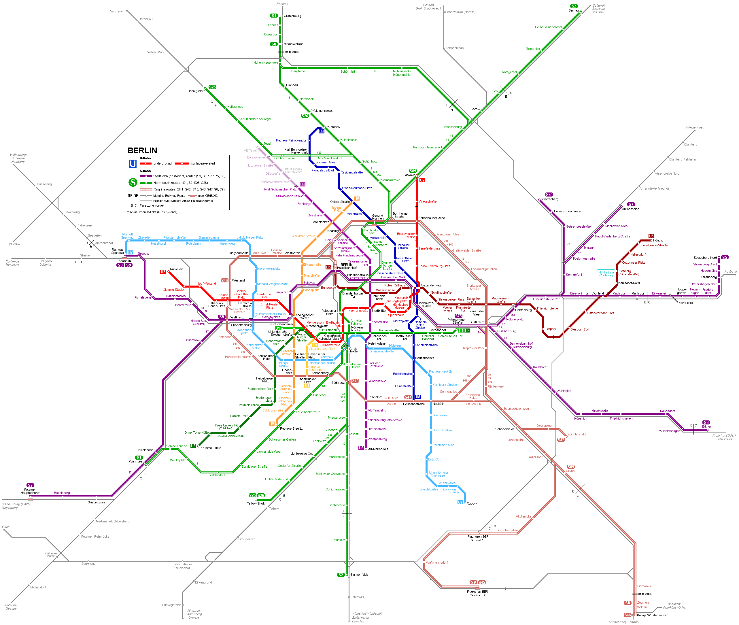
In West Berlin, the present line numbers were assigned in 1966, replacing the previously used letters. The prefix 'U' was added in 1984 to distinguish the U-Bahn lines from the S-Bahn lines taken over by the BVG. In East Berlin, however, no numbers were used on maps, neither for U-Bahn nor for S-Bahn lines. The Berlin U-Bahn system consists of two types of lines, both of which have the same track gauge of 1435 mm: 1) Small-profile
lines 2) Large-profile
lines |
|
| History | |
|
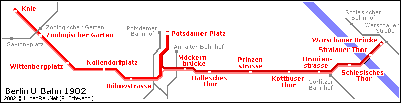
- The
first U-Bahn line opened in 1902 between Warschauer Brücke
(now Warschauer Straße) and Knie (now Ernst-Reuter-Platz),
with a branch to Potsdamer Platz. This first line (view
map) was mainly elevated. In the following years the network grew
steadily towards the west (today's |
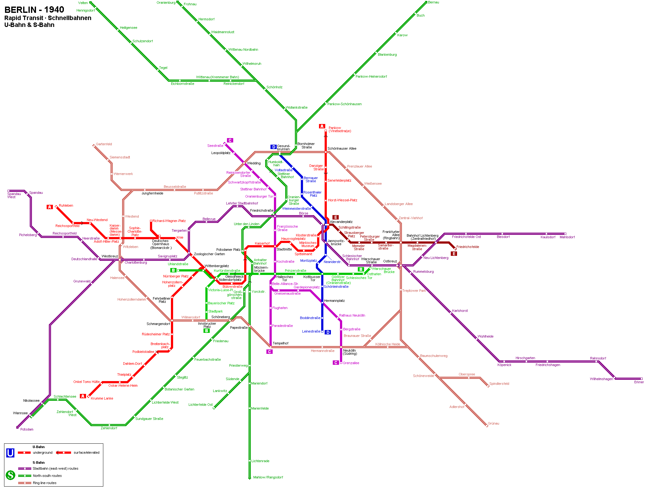
 Berlin
was restored as the German capital right after the unification of the
two German states in 1990 and has about 3.8 million inhabitants. The
city has one of the oldest and most extensive metro networks in Europe.
The rapid transit network actually comprises two separate systems, the
U-Bahn with 9 lines, and the
Berlin
was restored as the German capital right after the unification of the
two German states in 1990 and has about 3.8 million inhabitants. The
city has one of the oldest and most extensive metro networks in Europe.
The rapid transit network actually comprises two separate systems, the
U-Bahn with 9 lines, and the |
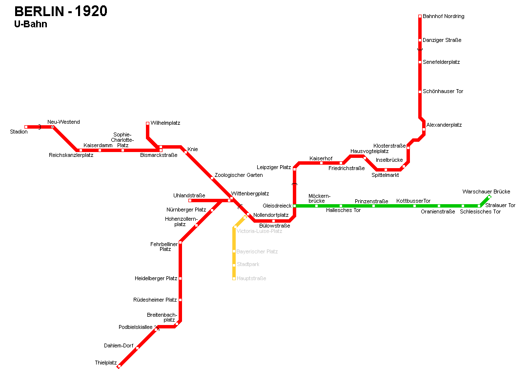
- After
the World War II, the U-Bahn and S-Bahn kept running from one side of
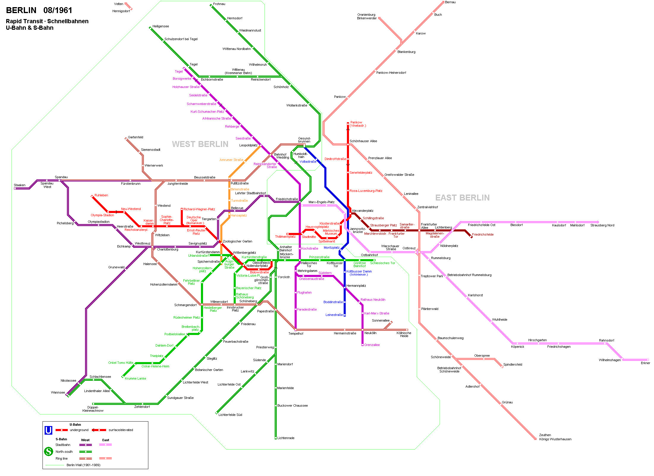
Berlin to the other until the Wall was built in 1961, when today's - While
Berlin was a divided city (view network map 1961),
on the eastern side of the Wall only line -
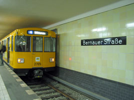
After the Berlin Wall was torn down in Nov. 1989, all ghost stations
were reopened as soon as possible, line -
In the meantime -
After 9 years of existence, line U15 disappeared from the map, instead
the number
-
On 7 May 2018, line -
The missing section on line
In
Dec 2020, Berlin's U-Bahn network has a total length of roughly 150
km and 9 lines, with line |
|
|||||
| Lines | ||||||
| ...— | ||||||
|
U1
|
Uhlandstraße
— Warschauer Straße
|
|||||
|
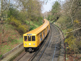
8.9 km (3.1 km underground) - 13 stations Line U1 starts underground at Uhlandstraße below Berlin's famous Kurfürstendamm. While the section to Wittenbergplatz hat already been opened in 1913, an additional station was added in 1961 to provide transfer to the new north-south line U9. At Nollendorfplatz, line U1 shares the 4-track underground station with lines U3 and U4 (between Wittenbergplatz and Nollendorfplatz, lines U1 and U3 share tracks). Between Nollendorfplatz and Gleisdreieck (upper level), line U1 runs along the so-called 'relief route' opened in 1926 to allow a direct line from Kreuzberg towards Wittenbergplatz, after the triangular junction at Gleisdreieck had been rebuilt into a two-level crossing in 1912. From Gleisdreieck to Warschauer Straße, line U1 uses the elevated route as opened in 1902, Berlin's oldest metro line. Due to the erection of the Berlin Wall, the line was curtailed at Schlesisches Tor between 1961 and 1995. More
about line
|
 |
|||||
|
U2
|
Ruhleben
— Pankow
|
|||||
|
20.7 km (14.5 km underground) - 29 stations From
Ruhleben, line U2 runs on an embankment to Olympia-Stadion, before entering
the first tunnel section, which runs through the district of Charlottenburg
to a point between Wittenbergplatz and Nollendorfplatz. The section
between Ernst-Reuter-Platz (formerly Knie) and Potsdamer Platz is part
of the original U-Bahn opened in 1902. More about
line
|
 |
|||||
|
|
||||||
|
|
||||||
|
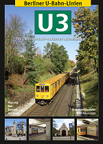
U3
|
Krumme
Lanke — Warschauer Straße
|
|||||
|
18.7 km (~8 km underground) - 24 stations Line U3 basically serves the Wilmersdorf-Dahlem U-Bahn, which, though connected to the Berlin U-Bahn from the beginning, was built by the then independent municipalities of Wilmersdorf and Dahlem, and therefore stations have designs different from the typical Berlin underground stations from that period. On the surface section, all stations have individually designed entrance buildings at street level. While the outer section through Dahlem runs in an open cutting, the route through Wilmersdorf is underground. From the 1960s, the Krumme Lanke branch was operated as line U2, but became line U1 in 1993, when the present U2 alignment was re-established. But in 2004, line number U3 was re-introduced and assigned to this leg. In May 2018, line U3 was extended to Warschauer Straße, sharing tracks with line U1 between Wittenbergplatz and the eastern terminus. More about
line
|
 |
|||||
|
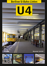
U4
|
Innsbrucker
Platz — Nollendorfplatz
|
|||||
|
2.9 km (underground) - 5 stations Line U4 was originally built by the city of Schöneberg as an isolated U-Bahn line, but to the same parameters used on the Berlin lines. It was eventually connected to the Berlin small-profile system in 1926, when the station at Nollendorfplatz was rebuilt, and through operation on the route to Warschauer Straße was introduced. In the 1980s, driverless automatic operation was tested on line U4. More about
line
|
 |
|||||
|
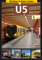
U5
|
Hauptbahnhof
— Hönow
|
|||||
|
22 km (8.5 km above ground) - 26 stations The
present U5 consists of an underground section opened in 1930, a short
underground section from 1973, an eastern surface extension completed
in 1988/89, the former U55 (Hauptbahnhof - Brandenburger Tor) and the
final intermediate section (Alexanderplatz - Brandenburger Tor). Line
U5 was once entirely located in East Berlin and was the only large-profile
line in that part of the city. Although a western extension had been
envisaged from the 1930s, this was only completed in 2020. According
to the old 200-km masterplan, line On line U5, every other train terminates at Kaulsdorf-Nord during off-peak hours. More about
line
|
 |
|||||
|
U6
|
Alt-Tegel
— Alt-Mariendorf
|
|||||
|
19.9 km (17 km underground) - 29 stations Line U6 was the first large-profile line when it opened in 1923. It runs along Friedrichstraße, Berlin's major north-south axis in the city centre. Initially the former Line C had two southern branches, but the eastern branch from Mehringdamm to Britz-Süd was transferred to the new line U7 in 1966. In the 1950s and 1960s, line U6 was extended at both ends to become Berlin's busiest north-south line. The northern extension to Tegel includes a 3-station elevated section. More about
line |
 |
|||||
|
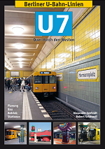
U7
|
Rathaus
Spandau — Rudow
|
|||||
|
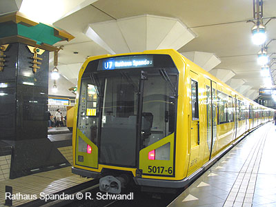
31.8 km (underground) - 40 stations Running below ground for approximately one hour, line U7 is Berlin's longest metro line. Its oldest part is the stretch through Kreuzberg/Neukölln from Mehringdamm to Grenzallee, which opened in the 1920s as a branch of the former line C (now U6). In 1966, line U7 became a separate line and was subsequently extended at the both ends. The western extension runs through Schöneberg, Wilmersdorf and Charlottenburg and eventually reached Spandau in 1984, at a time when there was no S-Bahn service to this area. Line U7 turned out to be an important cross-city line in what was formerly West Berlin. More about
line
|
 |
|||||
|
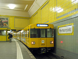
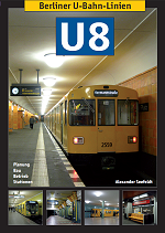
U8
|
Wittenau
— Hermannstraße
|
|||||
|
18.2 km (underground) - 24 stations Line U8 is completely underground and comprises the Gesundbrunnen-Neukölln U-Bahn line (Line D) opened in the 1920s. During the times of the city's division, U8 trains ran through East Berlin skipping all stations from Bernauer Straße to Heinrich-Heine-Straße. All 'ghost stations' were re-opened in the months following the fall of the Wall in Nov. 1989. The construction of a northern extension began in the 1970s and eventually reached Wittenau in 1994, although the initially 2-3 station extension to Märkisches Viertel was later shelved due to other priorities after the unification of the city. In the south, a 1-station extension was finished to provide interchange with the S-Bahn ring line which had re-opened in 1993. More about
line
|
 |
|||||
|
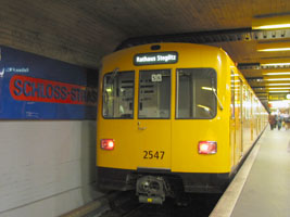
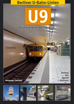
U9
|
Osloer
Straße — Rathaus Steglitz
|
|||||
|
12.5 km (underground) - 18 stations Line U9 was opened shortly before the Berlin Wall was erected in 1961. It runs entirely on former West Berlin territory and is an important north-south axis bypassing the historic city centre. It is completely underground, and thanks to its straight alignment one of Berlin's fastest lines. More about
line
|
 |
|||||
|
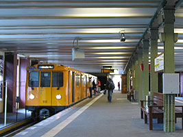
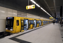
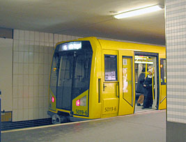
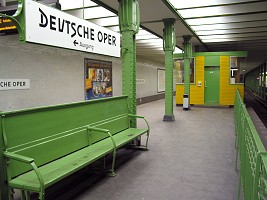
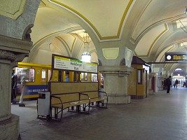
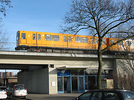
Photos © R. Schwandl (UrbanRail.Net) |
||||||
| <<< Up | U-Bahn | S-Bahn | Books | Videos | Links | ||||||
|
Projects |
||||||
|
After
the opening of the western U1:
Warschauer Straße - Ostkreuz |
||||||
|
|
||||||
| Links | ||||||
|
VBB (Tariff union Berlin-Brandenburg) U-Bahn Berlin at Wikipedia.de UndergroundBerlin by Christopher Land (incl. Videos & News) Berliner Verkehrsseiten by Markus Jurziczek Berliner U-Bahn Archiv by Axel Mauruszat (features historic documents) Berliner Verkehr by Ralf Müller incl. map and track map Berlin U & S-Bahn Gallery incl. all underground and elevated stations Berliner U-Bahn.info by Patrick Popiol U-Bahn-Museum (at U-Bahn station Olympia-Stadion - U2) Berlin U-Bahn Signals by Wolfgang Meyenberg Bwald - Bibliography about the Berlin U-Bahn U-Bahn.co (Station by station gallery by Ryan Hartman) |
||||||
|
<<< Up | S-Bahn | Tram | Books | Videos | Links
|
||||||
| Books | ||||||
|
||||||
| Other Books from Robert Schwandl Verlag | ||||||
|
Robert Schwandl: Berlin U-Bahn Album - All Underground and Elevated Stations in Colour. - 2nd edition, May 2013, 160 pages, German/English, ISBN 978 3 836573 39 8 More info Robert Schwandl: U-Bahn, S-Bahn & Tram in Berlin. - 3rd edition Feb. 2023, ISBN 978 3 836573 68 8 More info
|
||||||
| Other Books | ||||||
|
Arbeitsgemeinschaft Berliner Nahverkehr e.V. und Berliner Fahrgastverband IGEB e.V.: Berliner U-Bahn-Chronik. - 2007, GVE-Verlag, ISBN 978-3-89218-110-1 Andreas Biedl: Die Fahrzeuge der Berliner U-Bahn, Typ B. - June 2005, Neddermeyer, Berlin, ISBN 3933254566 Christoph Brachmann: Licht und Farbe im Berliner Untergrund. - Oct. 2003, 292 p. - Mann (Gebr.), Berlin, ISBN 3786124779 Verkehrsgeschichtl. Blätter e.V.(ed.): U5. Geschichte(n) aus dem Untergrund. Zwischen 'Alex' und Hönow. - 2003, GVE, ISBN 3-89218-079-2 Susanne Hattig, Reiner Schipporeit: Großstadt-Durchbruch. Pioniere der Berliner U- Bahn. Fotografien um 1900. - 2002, 176p, Jaron Verlag, ISBN 3897730642 Jan Gympel: U-Bahn Berlin. Geschichte(n) für unterwegs. - 256p., b/w, Verlag GVE, April 2002, ISBN 3892180725 Sigurd Hilkenbach, Uwe Poppel: Ein Jahrhundert Berliner U- Bahn in Streckenplänen und Fotos. [A century of Berlin U-Bahn in network maps and photos] - 80 pages, - Jaron Vlg., Berlin, 2002 ISBN 3897730499 Gauglitz,
Gerd and Holger Orb: BERLINS
S- UND U-BAHNNETZ. EIN GESCHICHTLICHER STRECKENPLAN.
- 2001, Edition
Gauglitz, ISBN 3-933502-09-8 Jürgen Meyer-Kronthaler, Klaus Kurpjuweit: Berliner U- Bahn. In Fahrt seit hundert Jahren. - 2001, bebra Verlag, Berlin Hardy, Brian: THE BERLIN U-BAHN. Capital Transport, 1996. - Well illustrated handbook. Domke, P. und M. Hoeft: TUNNEL, GRÄBEN, VIADUKTE. - 100 Jahre Baugeschichte der Berliner U-Bahn. - Kulturbild-Verlag, 1998. A good book that illustrates the history of Berlin's underground with lots of color and black and white photographs. Meyer-Kronthaler, J.: BERLINS U-BAHNHÖFE. - Die ersten 100 Jahre. - be.bra Verlag, 1996. Illustrates the history of all Berlin underground stations in the first 100 years. Gympel, Jan: U4 - DIE SCHÖNEBERGER U-BAHN - Gesellschaft für Verkehrspolitik und Eisenbahnwesen e.V, 114 pages, Nov. 2000 ISBN: 3892180903 U2. Geschichten aus dem Untergrund. - GVE e. V., 1998 U1. Geschichten aus dem Untergrund. - GVE, 1998 Lemke/Poppel: BERLINER U-BAHN. - 175 p., Alba, Düsseldorf, 1996. Well illustrated survey of the history of the Berlin Subway and Elevated Railway. Black & white and colour photographs. Gottwaldt, Alfred: DAS BERLINER U- UND S-BAHNNETZ. Eine Geschichte in Streckenplänen. - Argon, Berlin, 1994. Excellent book showing all Berlin Network maps from 1888 until 1990 in full colour. Pabst, Martin: U- und S-Bahn-Fahrzeuge in Deutschland. München: GeraNova, 2000. ISBN 3932785185 German metro and suburban rail rolling stock, 160 pages Günther Bellmann: Durch Berlin mit der U- Bahn. Wittenbergplatz bis Schönhauser Allee. 2001. bebra , Berlin Handke, Stephan: BERLIN UND SEINE U-BAHN - 1994 Horst Bosetzky, Uwe Poppel: Tegel, Zurückbleiben bitte! - 135 p., Jaron Vlg., Berlin, 1999, ISBN 3897730006 Andreas Biedl, Norbert Walter: Die Fahrzeuge der Berliner U-Bahn, Typ E - 2001, ISBN 3933254175 |
||||||
 -
In 1923 the first section of a new north-south line opened (former Line
C, now
-
In 1923 the first section of a new north-south line opened (former Line
C, now  -
In August 2009, three new stations opened on an isolated line, temporarily
referred to as line
-
In August 2009, three new stations opened on an isolated line, temporarily
referred to as line 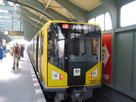


2004
© UrbanRail.Net by Robert
Schwandl.