| System | |
|
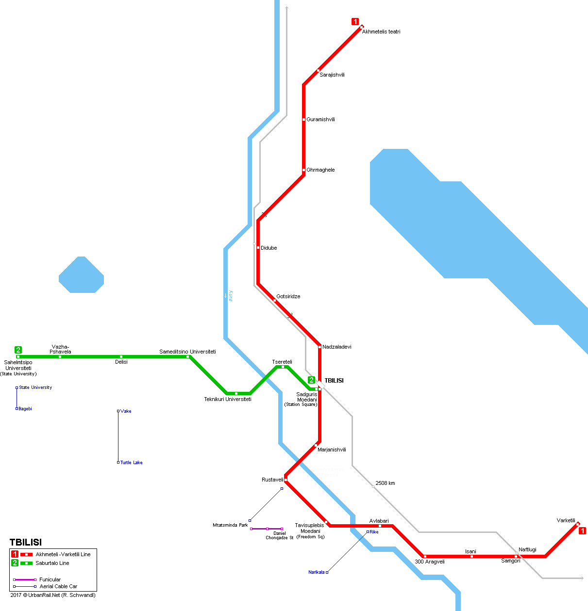
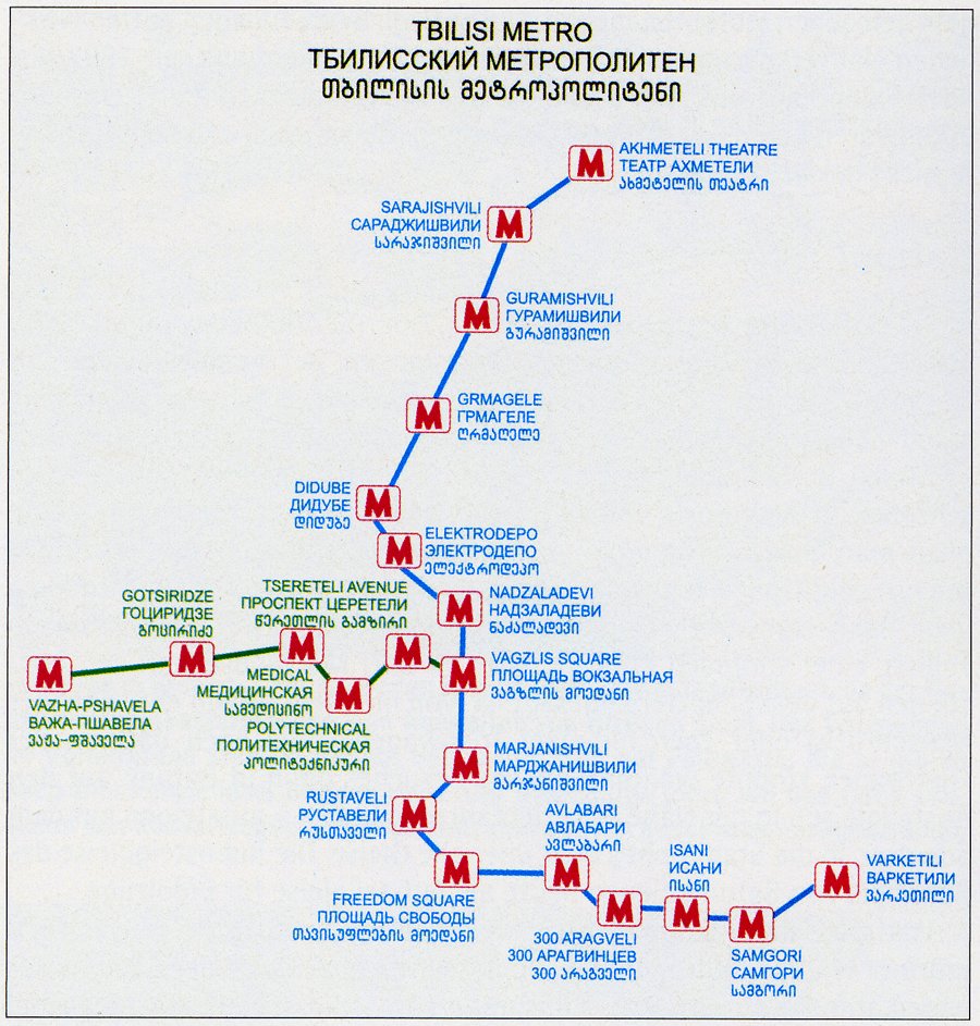
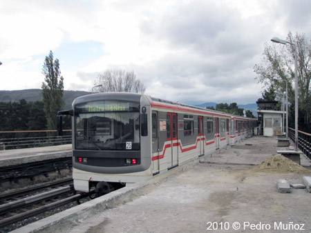
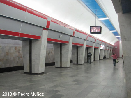
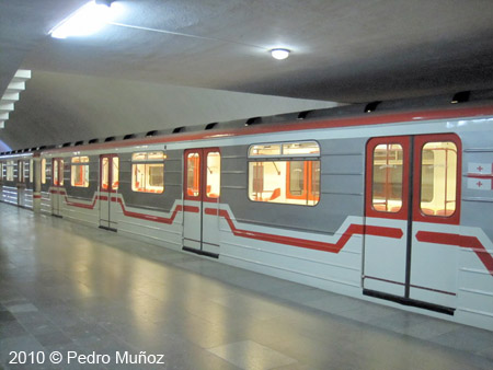
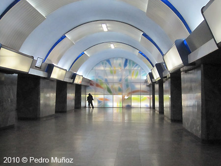
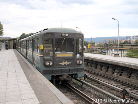
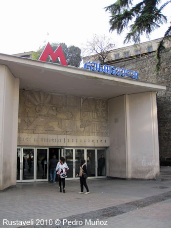
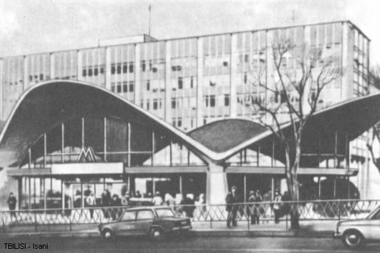
Tbilisi (Tiflis) is the capital of the former Soviet republic of Georgia, situated in the Caucasus. The city has 1.2 million inhabitants and extends 40 km north - south along the river Mtkwari (Kura). The valley is surrounded by mountains which makes road traffic especially difficult. Therefore plans for a subway system were made already in the early 1950's when the city had only 750,000 inhabitants. The first line (Akhmeteli-Varketili Line, formerly Didube-Samgorskaya) opened in 1966 from Dibude to Rustaveli (6.3 km, 6 stations) via the city centre. A few years later it was extended towards the south to 300 Aragveli (1967) and Samgori (1971). During the 1980's it reached its current length of 19.6 km with 16 stations. In 1979, the second line (Saburtalo Line) began operating between Vagzlis Moedani (railway station) and Delisi. In the year 2000 it was extended to Vazha Pshavela, before finally reaching its current western terminus in 2017. Most station names were changed during the 1990's after the dissolution of the former USSR and the independence of Georgia. Trains in service are of the 81-717 and 81-714 series also running in Moscow and other ex-Soviet cities. Stations have 100 m long platforms for 5-car trains, although only 3 or 4-car trains are currently used. |
|
| Lines and History | |
|
11
Jan 1966: Dibude - Rustaveli (6.3 km, 6 stations) Saburtalo Line - 7.7 km, 7 stations 15
Sept 1979: Sadguris Moedani (ex Vagzlis Moedani and
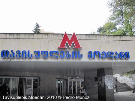
Pl. Vokzalna) - Delisi (6.2 km, 5 stations) Some (or all) station names have been changed from Russian into Georgian, so older names found on some maps are given in brackets. Other former names: Pl. Lenina for Tavisuplebis Moedani (Freedom Sq.); 26 Komissarov for Avlabari; Okyabrskaya for Nadzeladevi; Komsomolskaya for Medikal Institut. More station names were renamed in 2011: Elektrodepo > Gotsiridze; Vagzlis Moedani (1 and 2) > Sadguris Moedani (Station square); Tsereteli Gamziri > Tsereteli; Politeknikuri > Teknikuri Universiteti (Technical university); Sameditsino instituti > Sameditsino Universiteti (Medical University) |
|
| Photos | |
|
|
|
|
|
|
| Links | |
|
Tbilisi Transport Company (Official City Website) Metrosoyuza by Peter Donn includes nice station pictures Tbilisi Metro at Mir metro/Metroworld by Aksenov Dmitry |
|
| Photos | |
|
|
|
| Report | |
|
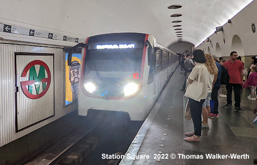
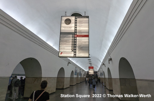
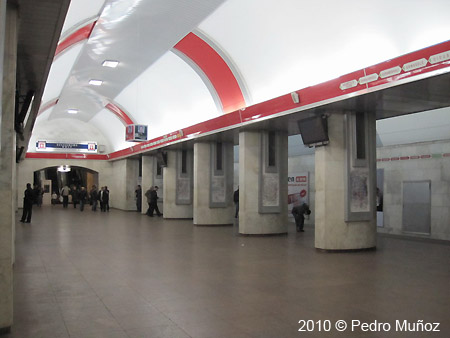
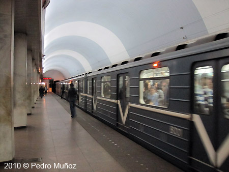
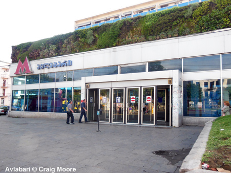
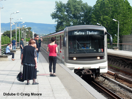
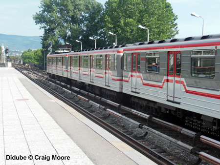
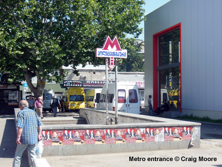
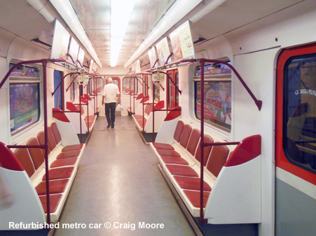
On 18 June 2014, Craig Moore reports from Tbilisi: The first thing to say is that this is a wonderful city. By far the nicest of the Caucasian capitals, with a pleasant climate, wonderful old town, surrounded by mountains and warm and hospitable people. Whilst dilapidated in parts, the city is being regenerated on a large scale. Although there is much to do (much of the citys infrastructure is still in a poor state of affairs), the work progresses well. My only concern here is that the renovation is too aggressive and looks almost fake. As Tbilisis urban development has followed the Mtkvari Valley, it is a long, stretched city and the Metro tends to follow this pattern with the main line running northwest-southeast and the Subartalo Line running west from Vagzalis Moedani. Although Tbilisi is the least sovietised of the former SSR cities I have visited, the Metro is definitely a child of the Soviet Union. Stations are quite prominent in the street scape, some are glass fronted blocks with the lethal swinging doors (pinned open in Summer), whilst others are steps down to the station. All have a prominent Red M logo that is difficult to miss. The station entrance/foyer are basic with a Casa, long escalators (this is a deep metro) leading to large vaulted and decorative platforms. These island platforms have many side arches leading to the quite shallow access platforms. Timing clocks at the end of the platforms give headway (approx. 5 mins) and the platforms are generally dark, dank and featureless with no maps, service information or even station signage. Such limited lighting down there and very drab in general. Services run from 0600 to midnight and services are operated by 4-car sets. The stock is the 81 type used in most soviet cities, although the vast majority of units have been modernised with a light grey and white scheme with red line. The new interiors are bright and clean white and orange with cushioned side seating. The other stock maintains the ubiquitous blue. Both types are noisy and there is no map or information inside the trains. With the lack of platform information this makes navigation quite difficult as you have to listen carefully to the audio announcements (sometimes they are difficult to hear even though they are in Georgian and English - Cyrillic is nowhere to be seen on the system). The only station signage is a large illuminated box often hanging from the ceiling which is located on the central platforms at 90 degrees to the tacks and so these are difficult to see. The speeds are quite fast but the stations are perhaps too well spaced and there are many central areas within the city where additional stations could be located. As for the interchange at Vagzalis Moedani, this is quite straight forward once you find out which end of the platform you exit from (signage in general is poor and there are no signs for the interchange line you simply follow the crowds), left along a 50 m corridor with beggars and buskers and then right down again. This is the same in either direction as the two lines run parallel initially. Interestingly, as you are on the stairs there is signage which just refers to 'first line' and 'second line' and not by name of line. I suppose the system is not designed for tourists and it also a very simple network and so expecting clear directional and spatial information is a little brazen. The lack of signage and information on trains/platforms is also translated into general customer information. There is none, save a crude schematic A4 map hidden in the corner of the ticket hall. No hard copy maps are available for passengers and there are no day tickets. They have ended fare tokens and now use a stored-value card. This costs 2.00 Lari to purchase (0.81) and each journey costs 50 Tetri (0.20). Queues at the Casa are minimal even though only one of the two windows are ever open. From experience I doubt the person who would normally be at the second window was away on a customer service refresher course! In fact the lack of queues also translates to patronage which I didnt find that high. Even at peak hour there was plenty of space on the trains. In addition to the Metro, Tbilisi also has a funicular but it runs at weekends only, and a new cable car to the narikala fortress. There is also a train line from the airport to the main railway station, but there are only two services per day 0700 and 1740. Considering that most flights arrive and depart in late evening or middle of the night this is a bizarre schedule. The new shiny station at the airport lies mostly empty! |
|
Thanks to Alexei Sinurin and Dmitry Merzlov!
2004 © UrbanRail.Net by Robert Schwandl.