|
[ UrbanRail.Net ] [ Europe ] [ Americas ] [ Asia ] [ Africa ] [ Oceania ] [ News ] [ Books ] [ Links ] [ Blog ] |
|
KOLKATA
|
| West Bengal . India |
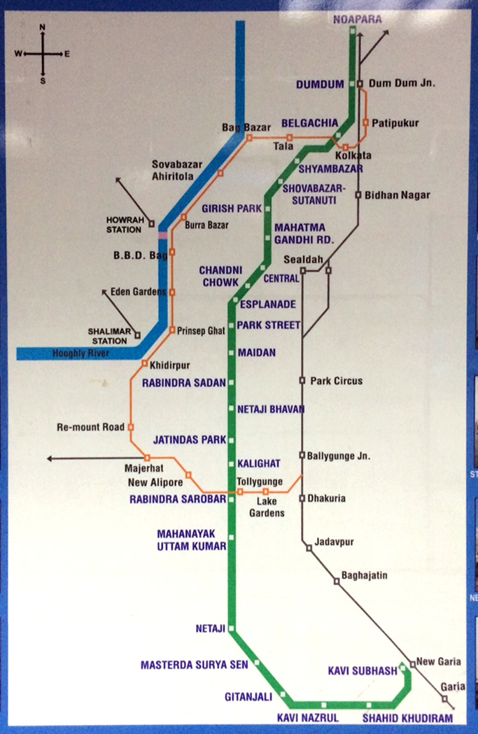
Click on map to expand!
![]()
|
METRO
|
|
|
|
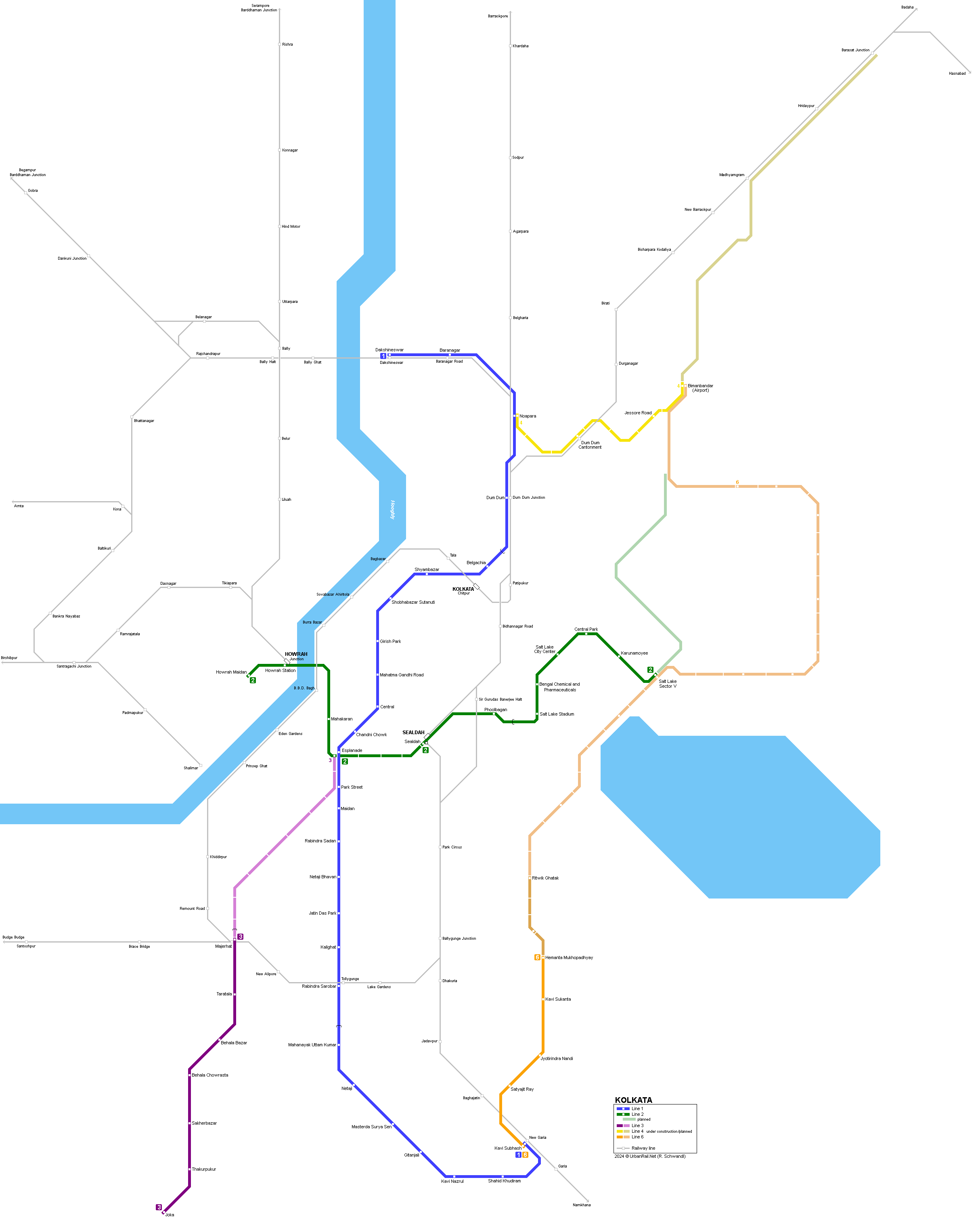
Blue
Line
|
|
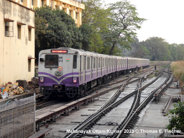
In 1971, a Master Plan was designed which included 5 rapid transit lines, of which the north-south route was considered the most important one. Construction (mainly cut-and-cover) began in 1973 and the first section opened for public service in 1984 between Esplanade - Bhowanipur (3.4 km). This was the first subway line in India. In 1995, the Kolkata Metro Railway reached a total length of 16.5 km and remained unchanged for the next 14 years. Along the route there were 17 stations (15 underground, 1 elevated and 1 on surface), with 160 m long platforms designed for 8-car-trains. Power supply is via third rail at 750 V dc. Eventually in 2009, the first 5.9 km section of a long-planned elevated southern extension was brought into service from the former southern terminus Tollygunge, now renamed Mahanayak Uttam Kumar, to Kavi Nazrul (planned as Garia Bazar). 24
Oct 1984: Esplanade - Bhowanipur (now Netaji Bhaban) (3.4
km) |
|
| Green Line |
|
Construction of this 16.6 km east-west line started in 2009. It runs from Salt Lake (Bidhannagar) Sector 5 (in east) to Howrah (in west). Trains are air-conditioned and underground stations have platform screen doors. It uses standard gauge, like Kolkata tram, but unlike line 1, which uses broad gauge. Between Mahakaran and Howrah Railway Station, the metro runs under the Hooghly River, while it is elevated along the eastern section through Salt Lake City. 13 Feb 2020:
Salt Lake Sector V - Salt Lake Stadium (5 km, elevated) |
|
|
| Purple Line |
|
Line 3 (purple) was originally planned from Mahakaran to Joka, later truncated at Esplanade. It will now run from Esplanade to Joka. Test runs are being carried out on a single track between Taratala to Joka on the elevated section, due to non-delivery of CBTC system, and the section from Taratala to Majherhat (also elevated) is under construction (1 station), where an interchange will be possible for suburban railway. Limited opening of Taratala - Joka section launched on 30 Dec 2022. 30 Dec 2022:
Taratala Joka (6.5 km) Limited
service! |
| Yellow Line |
|
Line 4 (yellow) connects the Airport with Noapara on the Blue Line: 22 Aug 2025: Noapara - Jai Hind/Biman Bandar (Airport) |
| Orange Line |
|
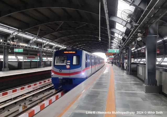
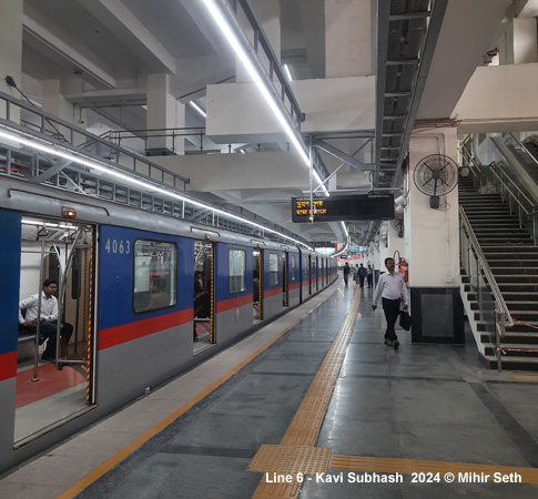
Line 6 (orange) is planned to run from Airport to New Garia via Saltlake Sector 5: 06 Mar 2024:
Kavi
Subhash Hemanta Mukhopadhyay (5.4
km) |
|
|
|
Projects |
|
Several lines are planned and/or even under construction, click here for details.
|
|
Photos
|
|
|
|
Report
|
|
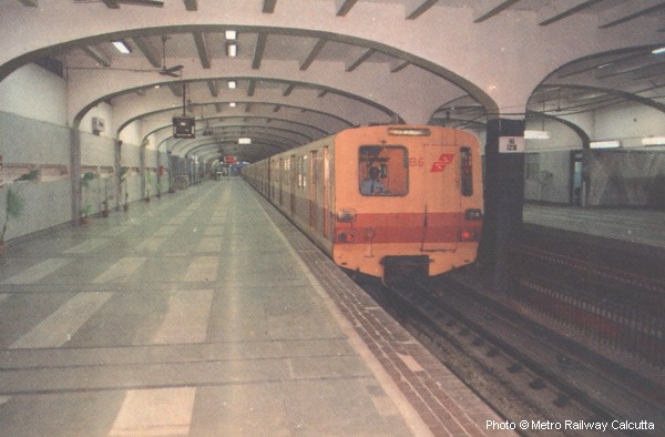
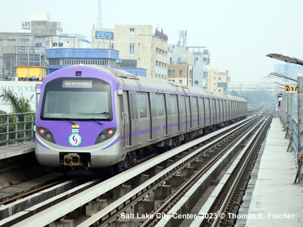
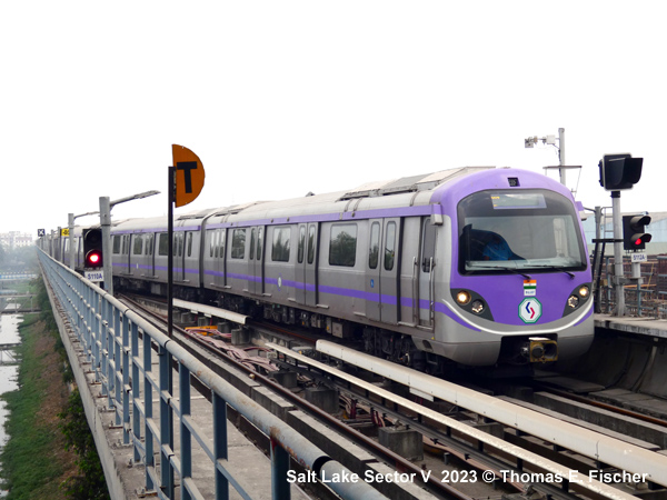
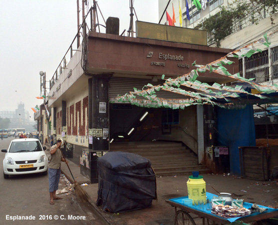
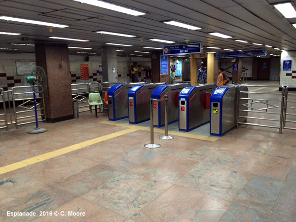
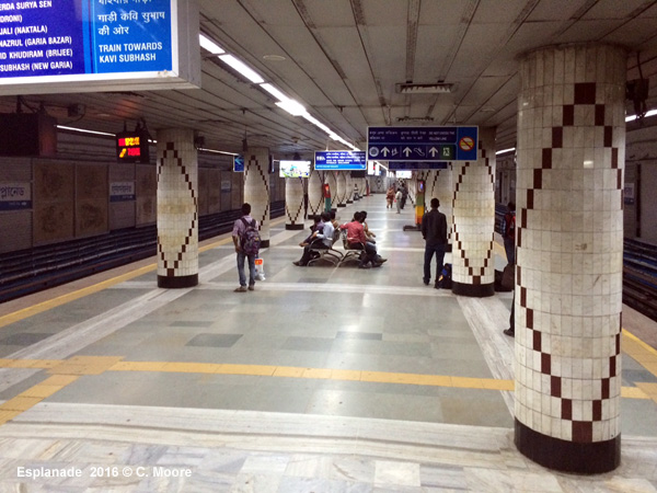
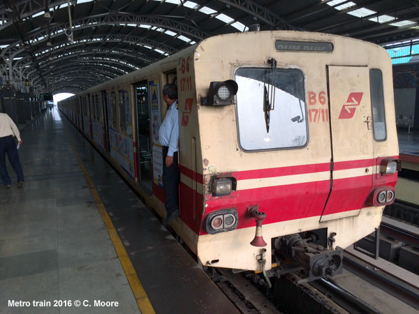
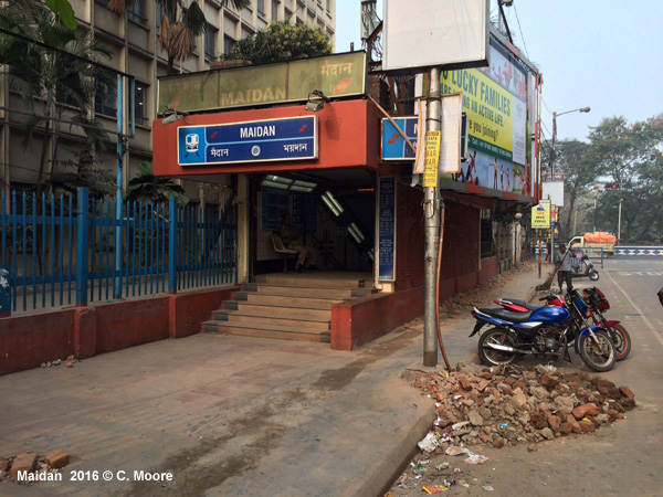
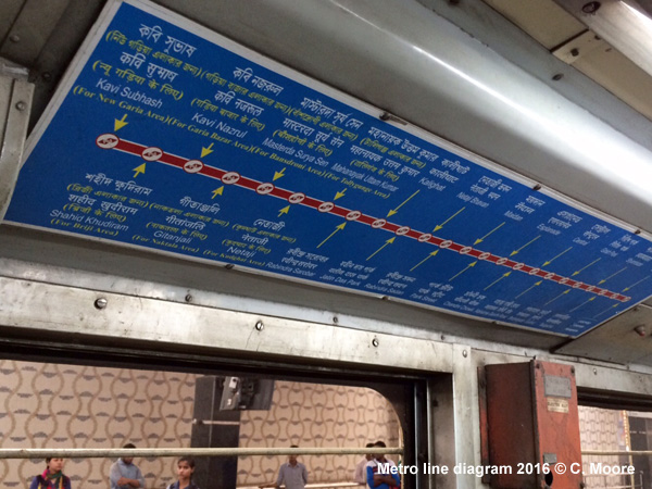
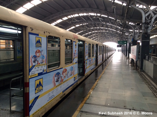
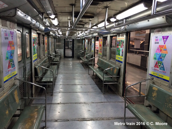
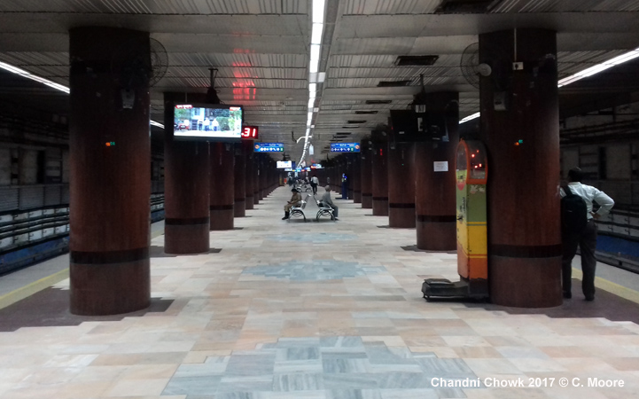
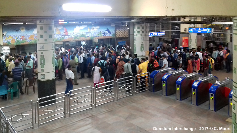
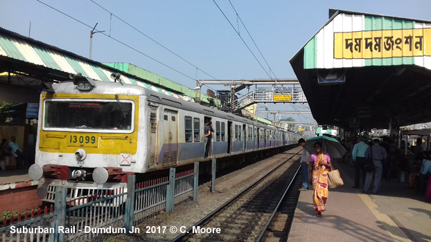
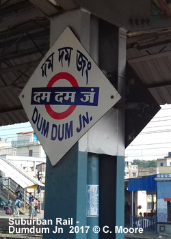
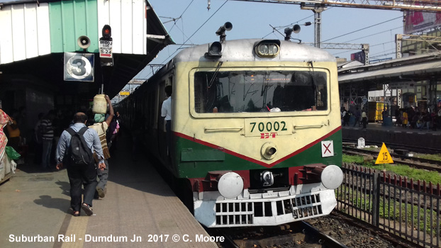
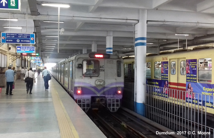
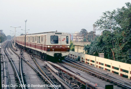
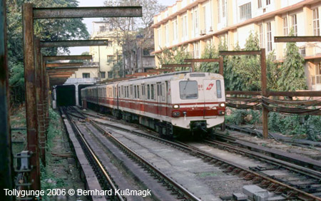
Craig Moore reports from Kolkata in Nov 2017: Kolkata might not have the order and power of Delhi, nor the dynamism, wealth and vibrancy of Mumbai, but it is, I feel, the most charismatic of the big Indian cities. As the first city on the sub-continent to have a Metro, the city is proud of its urban rail offer, although this is not stylish nor comprehensive. The Kolkata Metro Railway is a 24.6km single line (1676 mm gauge/third rail power) which runs from Noapara in the north to Kavi Subhash in the southeast (15.4km underground). Of the 24 stations, 15 are underground with the remainder of the line on elevated structures or at grade. The northern section of the line is a mix of grade (embankment), elevated and underground running, Noapara is the newest station on the system and is a large glass and cladding station with a broad and bright entrance. There are 2 side and one central island platforms here with most activity on the western platforms. Only 1 in 4 services start here (18min headway) and travelling south, there is a branch to the shedding facilities located at the east of the station. Running on elevated track the line runs parallel to the suburban rail lines, except a 0.4km underground section as the metro crosses these suburban lines and moves to the west before Dum Dum. Most services from the south terminate here at this busy interchange with a middle stub line to the north used as a switch. The station provides transfer to the frenetic suburban rail station (see below) which involves traversing the crowded entrance hall (both Metro and Suburban Rail) and then following the crowds down several passages or stairways to the suburban platforms. The Metro station was built in the early life of the metro and is of a different style to the newer examples in the south. It is worn but characterful with pale yellow concrete walls, tiled pillars and escalators/stairs. The side walls and roof are solid and there is little natural light, any luminosity coming from a series of fluorescents above the tracks. The side platforms are quite broad to cope with the heavy demand. The line soon drops below ground in a twin track cut-and-cover tunnel (15.2km), the tracks separated by occasional support sections. Running southwest and then south down the busy Central Avenue and Chowringee Road, the stations here have a wonderful utilitarian feel. The heavily built street entrances are not accompanied by a totem and are often surrounded by market stalls and a melee of street activity which makes them quite concealed in the busy streetscape. Once in the station, you notice how shallow this cut-and-cover system is. A short set of stairs brings you to the ticket hall with ticket office (titled bookings), ticket barriers (normally 2 or 3) and an unsophisticated and confused security process. Given the high usage, this area is always crowded. A basic but clear line map is located high on the wall as is a Metro Tourist map/guide based on Robert's Urbanrail map and next train indicators. Entrance halls are located at either end of the station and a further set of shallow stairs lead to the respective ends of the platforms. The island platforms (Park Station has side platforms) are long and straight with paired tiled pillars running the entire length (powerful fans attached), basic RTI, beautifully clear two-tone blue signage with exit information, occasional TV screens with local news, and a couple of weighing machines! Seating is located at the ends of platforms where the women only coaches stop. Some of the stations are less frayed and are brighter (mosaic walls) than others but all are characterful, functional and have effective passenger flows as commuters scurry to the respective ends of the platform for exit. Shortly before MUK, the line emerges to a grade section, which becomes elevated as it nears Kavi Subhash. The stations on this section have side platforms and are quite spacious and bright, although they have aged quickly. This is a simple system and is easy to use. Tickets come in the form of RFID tokens and fares are distance-based at 5-15 Rupees (0.07 - 0.21). Services leave each terminus from 0645-2200 and before 0900 services are at a 10min frequency, improving to 6min headways during the day. On Sundays, services dont start until 1000. The journey takes 49mins (plus an additional 6mins between Dum Dum and Noapara) and the ride is jerky and cramped, with trains incredibly busy with calm, quiet and respectful passengers. There are two stock types built by ICF. These are 8-car through-trains (first carriage is women only). The original 1000 series have a pale yellow and red livery and are very threadbare. The interior has metal side seating and is dirty, and rusting, and the gaps in the carriages quite open. The newer 3000 series trains have a metallic tone with lilac stripe. These are of better quality with a less frayed feel. Both types of train have a crude strip map above exit doors and there are next station audio announcements in Bengali, Hindi and English. The Metro in Kolkata offers a very different and unique experience. Its age shows and capacity cannot cope with demand. This is not a clean, bright, air-conditioned journey - it is indeed hot crowded, frayed, unkempt and hectic, but it is a truer reflection of India than some of the newer Metro systems in this country. India has come a long way in metro development in recent years and this should be applauded, but the Kolkata Metro, like the city itself, functions well, exudes character and is an absolute joy - one to treasure. In addition to the Metro, Kolkata also hosts the largest electrified suburban rail network in India. Although this system does not have the service intensity, nor the cohesive brand of similar systems in cities such as Mumbai or Chennai, it remains an important and comprehensive rail provision in the urban area, covering both Kolkata and Howrah on the western banks of the Hooghly. The Indian Broad Gauge electrified system is operated by Eastern Railways (ER) and South Eastern Railways (SER) and within the urban area proper operates 11 lines over 136.2km. It has 61 stations. The total network is much larger and ventures far into the hinterland. The system uses 9, 10 and 12 car Jessop and ICF stock.
|
| Suburban Rail |
|
|
|
Links
|
|
Metro Railway Kolkata (Official Site) KMRC (Line 2 - Official Site) Kolkata Metro at Wikipedia Kolkata Metro Projects (TheMetroRailGuy)
|
 |
|
|
2007 © Robert Schwandl (UrbanRail.Net)
Local map, clearly based on UrbanRail.Net's map (Photo C. Moore, 2016):