| METRO |
|
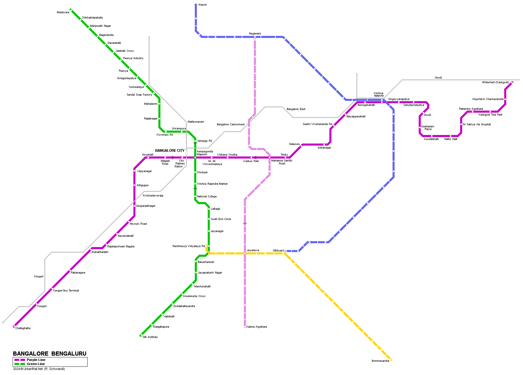
Bengaluru (formerly known as Bangalore), capital of the Southern Indian state of Karnataka, has a population of 5.7 million in the metropolitan area and about 4.2 million within the city limits. In 2003, Delhi Metro Rail Corporation (DMRC) commissioned a detailed study for a Metro, to be done along the same technical & financial approach used in Delhi. The study recommended a 2-line metro in the first phase, cross-shaped, 33 km long with 32 stations (an east-west line of 18km & a north-south line of 15km) intersecting in the city centre. About 8.9 km of the alignment within the city centre was to be underground and the rest on elevated viaducts. Station spacing was to be 1 km on average. Construction started in spring 2007 on the elevated section from M.G. Road (Mahatma Gandhi Rd) to Baiyappanahalli. |
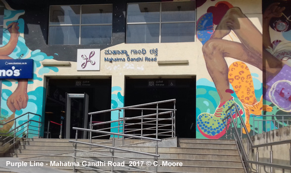
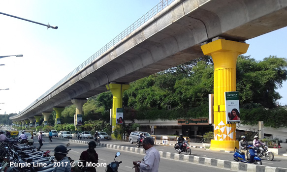
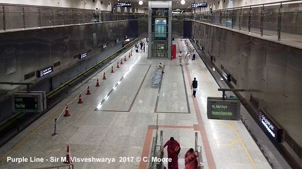
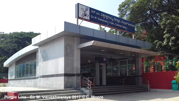
| Purple Line |
|
East-West Line: 43.5 km (3.4 km underground) 20 Oct
2011: Mahatma Gandhi Road - Baiyappanahalli (6.7 km) |
|
|
| Green Line |
|
North-South Line: 33.5 km (3.3 km underground) 28 Feb
2014: Sampige Road - Peenya Industry (9.8 km) |
|
|
| Yellow Line |
|
Elevated line towards the southeast: 18.8 km 10 Aug 2025: Rashtreeya Vidyalaya Road Delta Electronics Bommasandra
|
|
|
| Links |
|
Namma Metro - BMRCL (Official Website) Bangalore Metro / Namma Metro at Wikipedia The Metro Rail Guy > Bangalore Projects
|
| Photos |
|
| Report |
|
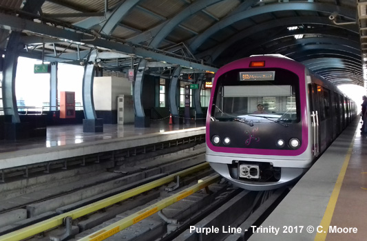
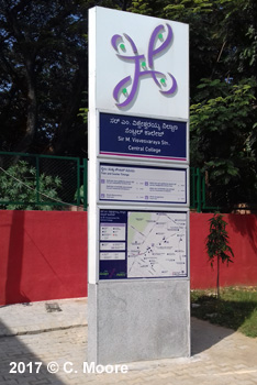
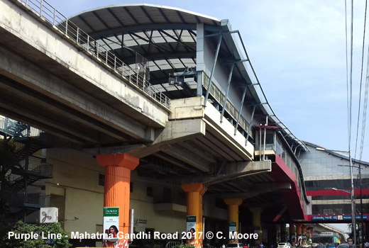
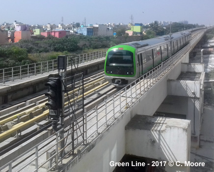
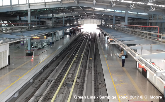
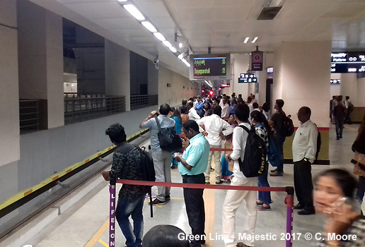
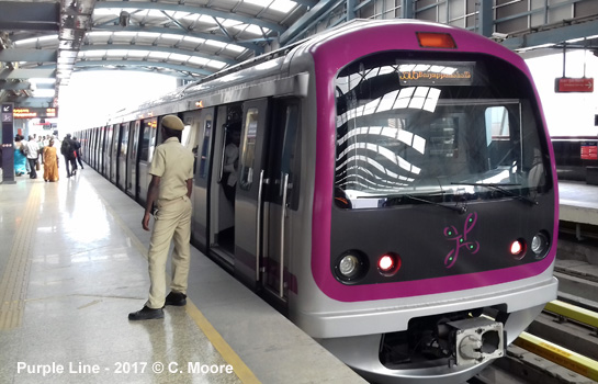
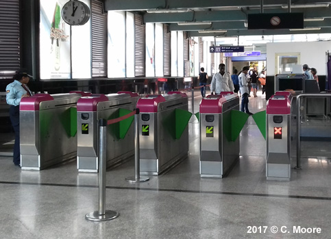
In November 2017, Craig Moore reports from Bengaluru: The Bengaluru Metro (known as the Namma Metro) has opened in different stages since its inauguration in 2011 and has several distinct features when compared to other systems on the Sub-continent. The system was built from the outside in, with the original sections in the outer areas in the east (Purple Line) and north (Green Line). Only more recently has the underground section in the centre of the city been opened to facilitate the current + formation. The current 42.4km system has 40 stations (7 underground) and is the second longest in India, utilising third-rail power supply (only the original Indian metro in Kolkata uses this) and runs on standard-gauge track. The 18.2km Purple Line runs east-west and is mainly elevated (4.8km underground). The original section from MG Road east to Byappanahalli (for connection to suburban/regional rail services) consists of large and rather dated stations with entrance level (security); mezzanine level (ticket hall/barriers) and platform level. These are huge spaces and are quite dark and unkempt (a trait of many Indian metro stations). The side platforms have RTI, line map and signage in Kannada and English only (no Sanskrit-Hindi). The platforms are capped by a high arched roof and blue support girders. Heading west, the line moves underground before Cubbon Park (the station for the cricket ground) and through to Majestic, the railway station/Kepegodawa bus station. This underground section opened in 2016 and the stations have a modern, cool look with smart street entrances and totem with the lovely swirling logo, island platforms, mezzanine side walkways, and decent platform furniture. These are the most modern underground stations I have seen in India. The line then becomes elevated again at Magadi Road all the way to the terminus at Mysore Road. This section is two years old and the stations are quite basic and look a little tired. The entire journey takes 36mins. The longer Green Line runs north-south for 24.2km with a short 4.0km underground section in the centre. The northern section opened in 2014 and runs on broad elevation through Peenya. The stations on this section from Nagasandra to Sampige Road are again quite large structures with standard features and side platforms, although Sampige Road itself is a more moderately and appropriately scaled structure with side entrances and a flatter peaked roof and deep side platforms. This station affords great views of train movements from a cross-platform bridge. The line south of here heads underground through Majestic, Chickpet and KR Market on the newest section of the Namma Metro. These underground stations have a similar style to those on the Purple Line and are an impressive development in station design in India. Before National College the ramp to the elevated section begins and continues to the southern terminus at Yelachenahalli. The stations on this section are large structures but understandably look newer and have arched roofs with side platforms. The journey takes 45mins. Transfer between the lines is at the huge Majestic station. This is the largest Metro station in India and is very busy. The Green Line lies below and perpendicular to the Purple Line and each side platform/track is separated by a broad wall. Platforms are not overly deep and the masses alighting and transferring mean that it is quite crowded. This is exacerbated by the fact that (as with all stations on the system) the platforms are built for 6-car sets, yet only 3-car sets are used (the remainder of the platforms are cordoned off) and so all the crowds are concentrated at one end of each platform. A queuing system is in place on the platforms but the crowds present when a train arrives means that there is always a bit of a free-for-all despite the best intentions of passengers. Signage is plentiful and there are numerous stairs/escalators to the various levels. The platform areas have a pale yellow tone and they dont have the finish of the other underground stations on the system. The climb through various levels brings you to the circular surface level entrance hall and this is a large space with a newer feel. Several of the entrance ways have been blocked off but there are information centres/ticket offices and stylish information boards including the modern system map, locational information, line map and service information. The system is quite simple to use but both lines are very busy. Services operate 0600-2200 with base headways of 10mins for each 3-car train (not enough capacity to meet demand). The trains stop at the far end of each long platform (the remainder of space cordoned off) and they are always full but boarding/alighting is fast (this is one of the many joys of metro travel in India). There are no ladies carriages or platform waiting zones for females only. The ride is smooth and efficient and the locally built BEML/Rotem stock is smart with line-specific green or purple frontage and side stripe, side seating, air conditioning, strip maps in Kannada and English and multi-lingual audio. Fares are distance-based (10-45 Rupees) and come in the form of black RFID tokens (I believe there is a day ticket which also includes use on buses although I can't confirm this If so, this modal integration is also unique in India). There is no hard-copy information available. This is an interesting system in that it has some unique features and, having opened in several stages, there are differing styles and qualities. There is a good mix of alignments, some big leaps in style and scale with the underground section and more is to follow with bold expansion plans and a much needed airport link.
|