|
[ UrbanRail.Net ] [ Europe ] [ Americas ] [ Asia ] [ Africa ] [ Oceania ] [ News ] [ Books ] [ Links ] |
|
WASHINGTON D.C.
|
| USA |
|
METRO
|
|
|
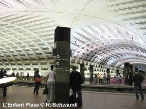
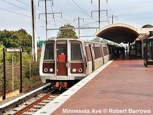
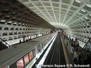
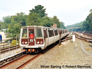
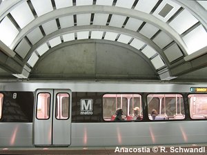
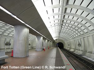
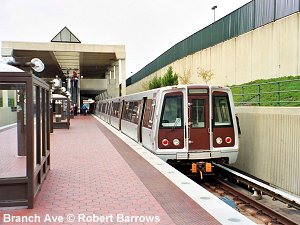
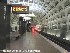
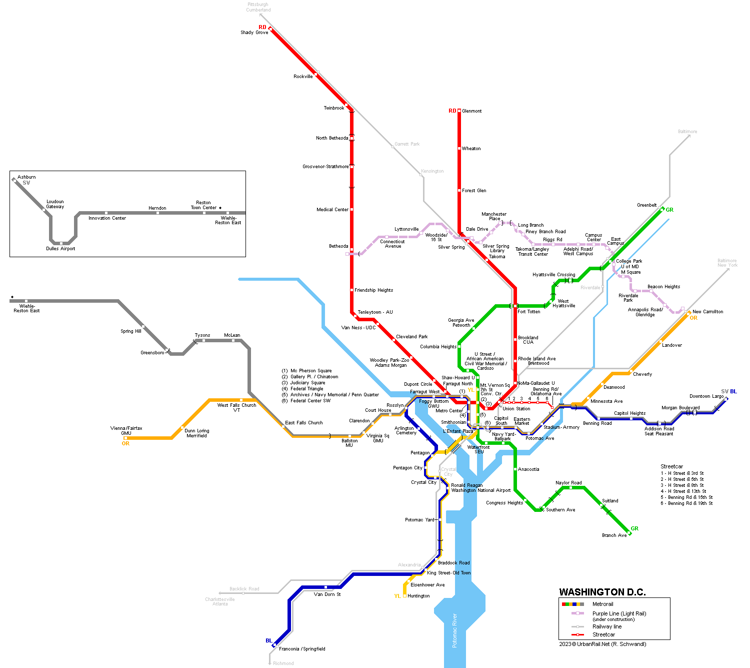
Washington, D.C., has a population of approx. 600,000, although with some 3.9 million in the metropolitan area, which extends into their neighbouring states of Maryland and Virginia. Compared to older subways, Washington's underground stations feature spacious vaulted roofs. Most outer branches run on the surface, the Orange Line towards Vienna runs in the median strip of an expressway. Apart from the Red Line, all other five lines form an interlaced network with up to three lines sharing tracks and platforms along certain stretches. In Nov 2022, the system has a total length of 205.5 km (~88 km underground). |
|
| Photos | |
|
|
|
|
History
|
|
|
27
Mar 1976 - Red Line Farragut
North - Rhode Island Ave (6.8 km) 22
Sep 1990 - Red Line Silver Spring
- Wheaton (5.2 km) 29
Jun 1997 - Blue Line Van Dorn St
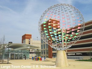
- Franconia-Springfield (5.3 km) 26 July 2014 - Silver Line Wiehle-Reston East - East Falls Church (- Largo Town Center) (18.7 km) 25 May 2019 - Yellow Line extended from Fort Totten to Greenbelt, sharing tracks with Green Line, but in 2023 it was cut back from Greenbelt to Mt Vernon Square 15 Nov 2022 - Silver Line - Wiehle/Reston East Ashburn (17.9 km) [Project website] 19 May 2023: + Potomac Yard, on the Blue/Yellow Line between Ronald Reagan Washington Intl Airport and Braddock Road stations in Alexandria 31 Dec 2025 - Yellow Line returns to Greenbelt with every other train, sharing tracks with Green Line Renamings in 2022: White Flint station > North Bethesda, Largo Town Center > Downtown Largo, Tysons Corner > Tysons, Prince Georges Plaza > Hyattsville Crossing |
|
|
Projects |
|
|
Running through Maryland, the Purple Line will be a 25.5 km tangential light rail route through the northeastern areas of the Washington D.C. metropolitan area (2027). See project website!
|
|
|
Photos
|
|
|
|
|
| DC Streetcar | |
|
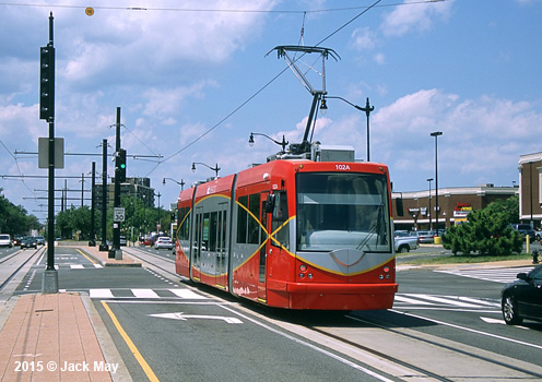
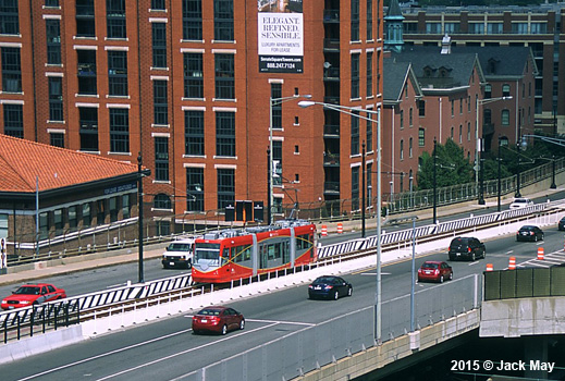
To complement the Metrorail system, Washington DC was bringing back streetcars in a modern version. The first line eventually opened on 27 Feb 2016, running east along H Street from Union Station to Benning Road (3.3 km), but service was discontinued on 31 March 2026! |
|
|
|
|
|
Books
|
|
|
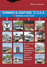
Robert Schwandl: SUBWAYS & LIGHT RAIL in the U.S.A. - Vol. 1: East Coast. - Sept. 2010, ISBN 978-3-936573-28-2 (More) Washington Metropolitan Area Transit Authority: METRO AT 25. Celebrating the Past. Building the Future. - WMATA, 96 p, A4, largely illustrated, colour, ISBN 0970871902 (More) |
|
|
|
|
|
|
|
|
Photos
|
|
|
|
|
|
Links
|
|
|
WMATA (Official Page) DC Streetcar (Official Page) MARC Commuter Services (Maryland Transit Administration) VRE Commuter Services (Virginia Railway Express) Washington D.C. Metrorail at Wikipedia Washington D.C. Metrorail at nysubway.org Jon Bell's Washington D.C. Page More of Jon Bell's photographs Building the Washington Metro: An Online Exhibit by Zachary Schrag
|
SUBWAYS
& LIGHT RAIL Click here for more info! |
|
|
|
2007 © Robert Schwandl (UrbanRail.Net)