|
[ UrbanRail.Net ] [ Europe ] [ Americas ] [ Asia ] [ Africa ] [ Oceania ] [ News ] [ Books ] [ Links ] |
|
ST.
LOUIS
|
| Missouri . USA |
Click on map to expand to full size!
|
System
|
|
|
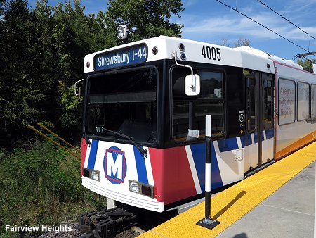
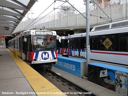
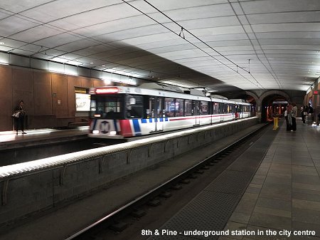
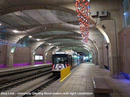
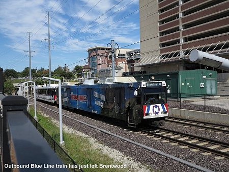
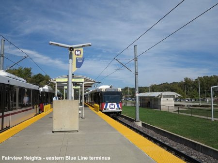
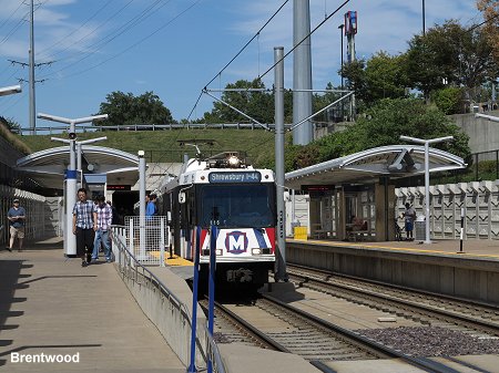
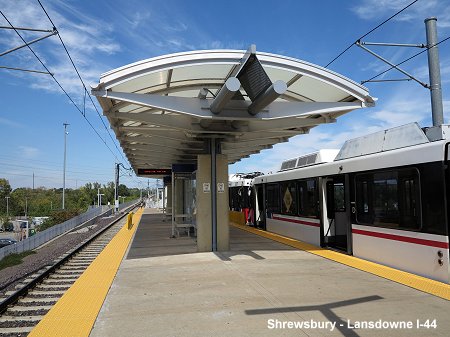
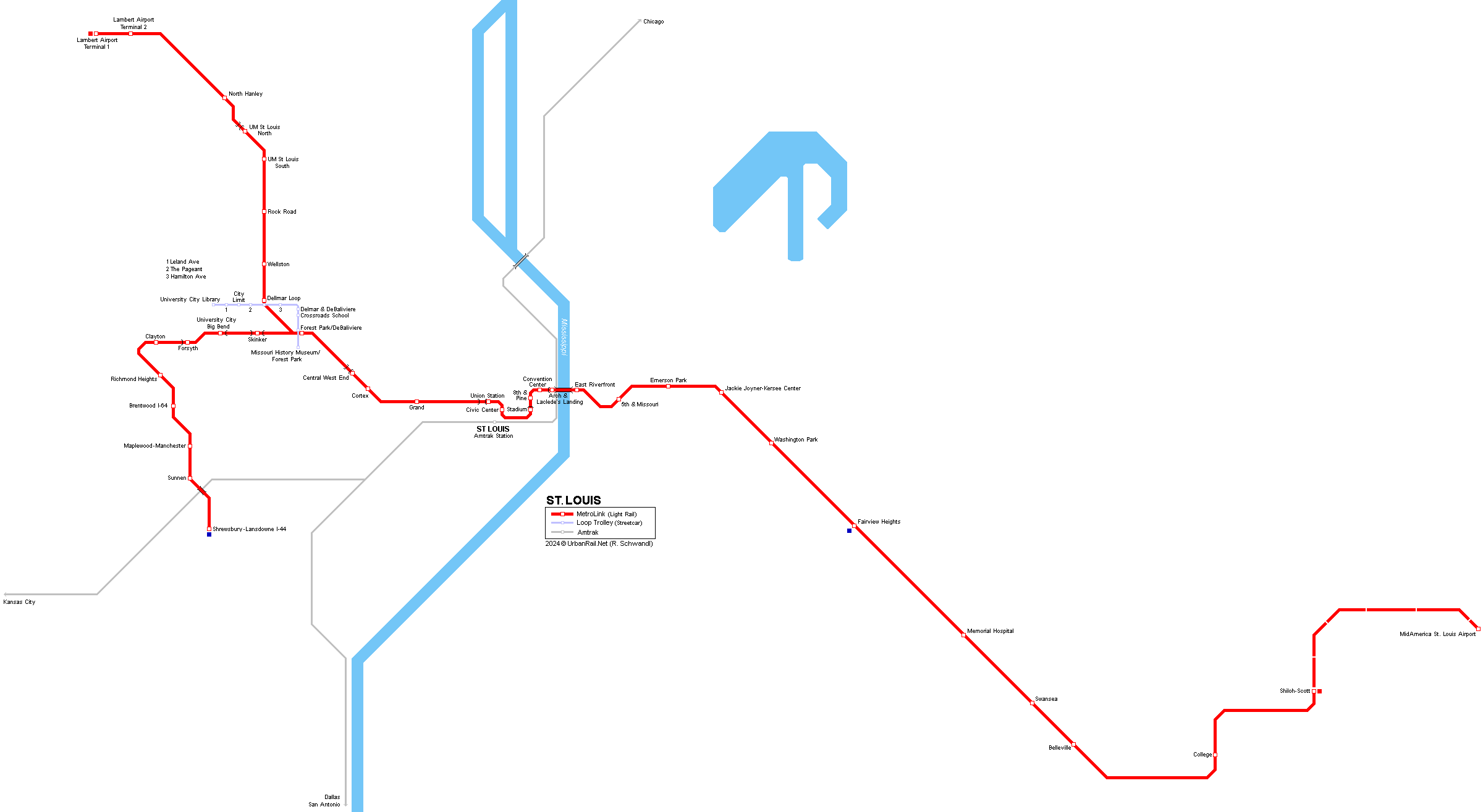
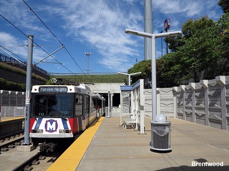
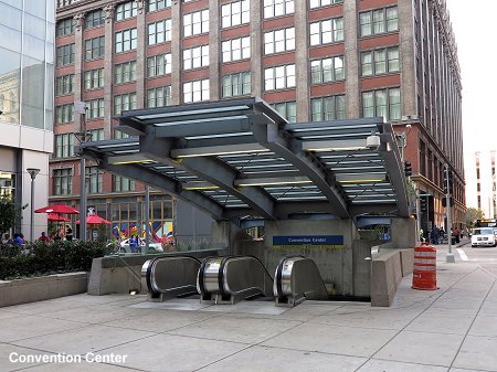
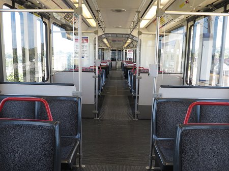
In 1994 an extension was approved through Saint Clair County in Illinois. The first 28 km stretch from 5th & Missouri to Southwestern Illinois College in Belleville opened in May 2001, followed by a 5.6 km stretch up to Shiloh-Scott in June 2003. Apart from some new stretches the former CXS rail alignment is used. The next extension was a 12.8 km branch off Forest Park station towards the southwest through Clayton to Shrewsbury, the so called Cross County Extension. It includes some underground sections (Skinker, University City/Big Bend and Forsysth stations, the latter partly open on one side). With construction having started in April 2003, regular service on this branch began on 28 Aug 2006. Trains from Shrewsbury normally operate through the city centre and terminate at Fairview Heights in Illinois. MetroLink is operated by Bi-State-Development-Agency, now simply 'Metro', and has a total length of 73.3 km. One light rail car has a capacity of 72 passengers seated and 106 standing. In late 2023, the construction of an 8.8 km extension from Shiloh-Scott to MidAmerica St. Louis Airport started, for completion in 2026.
|
|
|
History
|
|
|
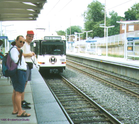
31
July 1993 - 5th & Missouri - North Hanley
|
|
|
Photos
|
|
|
|
|
|
LOOP TROLLEY |
|
|
A 3.5 km vintage streetcar line, the Loop Trolley, started running on 16 Nov 2018 from the Missouri History Museum at Forest Park to "The Loop" along Delmar Blvd, but due to low ridership, service was suspended on 29 Dec 2019! Trolley service was resumed on 4 Aug 2022.
|
|
|
Links
|
|
|
MetroLink (Official Site) Loop Trolley (Official Site) MetroLink at New York City Subway Resources Metrolink at Wikipedia More pictures at lightrail.com BLOG: Read your webmaster's impressions of the St. Louis MetroLink (Sept 2014) |
Our
Book: USA - Midwest & South
|
|
Photos
|
|
 |
|
1995 © UrbanRail.Net
2007 © Robert Schwandl (UrbanRail.Net)
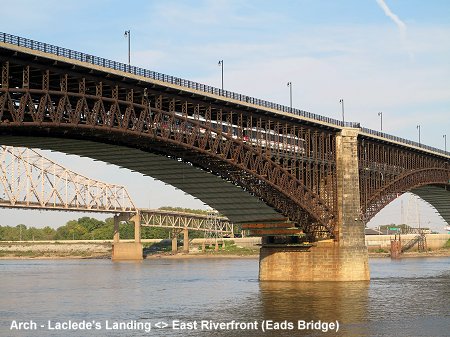
 The
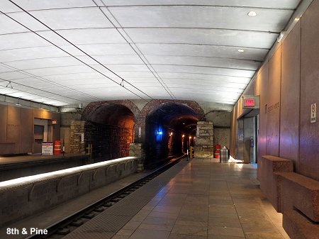
St. Louis MetroLink is a light rail line which runs on independent right-of-way
for all of its alignment, although with several level crossings. The original
line, which opened in 1993 (27 km), starts in East St. Louis, Illinois,
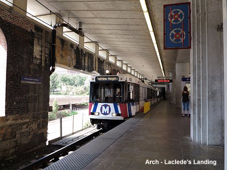
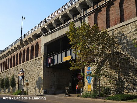
and crosses the river Mississippi on the historic Eads Bridge built in
1874. After Laclede's Landing it enters a former railway tunnel
which hadn't been used since 1974. It continues partly underground on
a new alignment to Union Station (former railway station - now
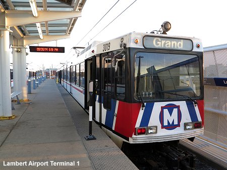
a shopping centre) and finally along the former Wabash railroad towards
the northwest and into the Lambert airport grounds.
The
St. Louis MetroLink is a light rail line which runs on independent right-of-way
for all of its alignment, although with several level crossings. The original
line, which opened in 1993 (27 km), starts in East St. Louis, Illinois,
and crosses the river Mississippi on the historic Eads Bridge built in
1874. After Laclede's Landing it enters a former railway tunnel
which hadn't been used since 1974. It continues partly underground on
a new alignment to Union Station (former railway station - now
a shopping centre) and finally along the former Wabash railroad towards
the northwest and into the Lambert airport grounds.