|
[ UrbanRail.Net ] [ Europe ] [ Americas ] [ Asia ] [ Africa ] [ Oceania ] [ News ] [ Books ] [ Links ] |
|
PHILADELPHIA
|
| Pennsylvania . USA |
|
System
& History
|
|
|
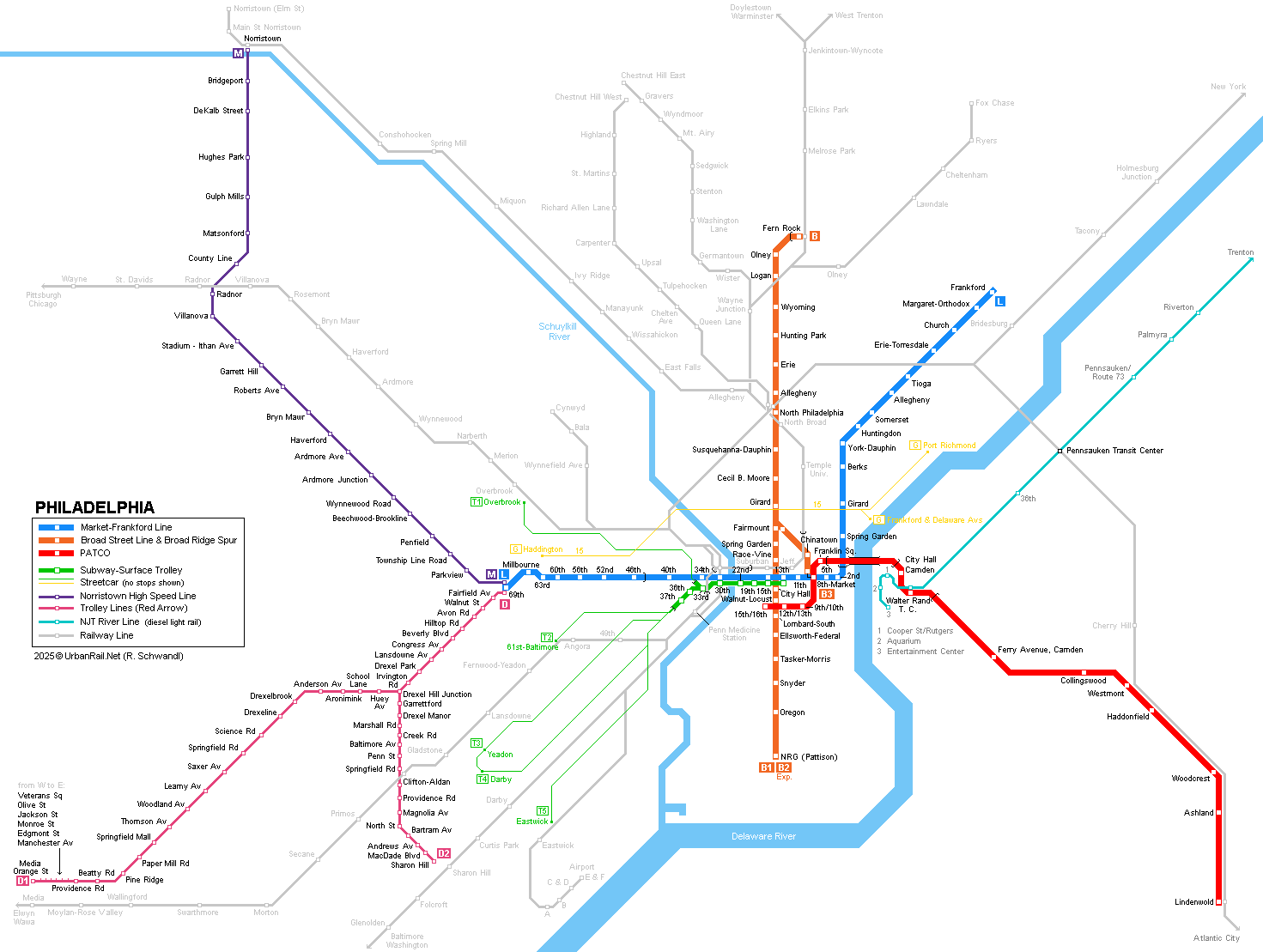
Philadelphia, Pennsylvania, has some 5 million inhabitants in the metropolitan area and is situated half way between New York and Washington. Philadelphia boasts one of America's most diversified urban rail networks, with subway, elevated, trams on the surface and in tunnel, as well as an extensive suburban railway system. Except for the PATCO Line, all lines are operated by SEPTA (Southeastern Pennsylvania Transportation Authority). |
|
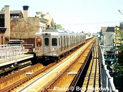
| [L] Market-Frankford Line | |
|
|
- 20.8 km
(5.8 km underground through city centre) 1907: 69th
St- 15th St (elevated from 69th St to approx. 23rd St) |
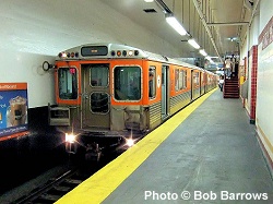
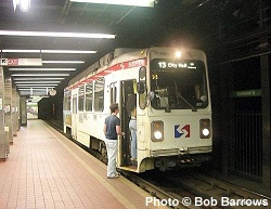
| [B] Broad Street Line & Broad-Ridge Spur | |
|
|
Broad Street
Line - 16.2 km (all underground except Fern Rock station) - 22
stations - Between
Olney and Walnut-Locust 4 tracks: 2 local and 2 express
tracks. 1928: Olney
City Hall |
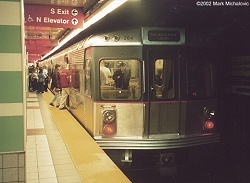
| PATCO (Lindenwold - Camden) Linee | |
|
|
The PATCO (Port Authority Transit Corporation) Line links Philadelphia with Camden and Lindenwold in New Jersey. The PATCO Line runs underground from its Philadelphia terminus as 15th/16th St on Locust Street to a point past 8th St, then crosses the Delaware River on the lower deck of the Benjamin Franklin Bridge, before returning underground through Camden town centre. The southern leg lies on an embankment with elevated stations from Ferry Avenue to Lindenwold (except for Haddonfield station, which is in an open cutting). - 23.3 km
(4.6 km underground, 3.7 km elevated) - 14 stations 1936: 8th
- Camden Broadway (former Bridge Line) |
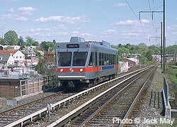
| [M] Norristown High-Speed Line | |
|
|
Route 100 is a 21.6 km light rail line, which starts at the western terminus of the Market-Frankford Line at 69th Street Terminal and serves the western suburbs and Norristown. This line is totally segregated from other traffic and uses 3rd rail power supply. Stations have high platforms, but at some stops these are just long enough for boarding at the front door. A 7 km branch is planned to serve King of Prussia [Project Website]. |
| [T] Subway-Surface Trolleys | |
|
|
The Market Street trolley tunnel was built together with the Market-Frankford Line and is served by a total of five streetcar (trolley) lines, which run mostly on-street through the western parts of Philadelphia. West of 30th Street station, the trolley tunnel diverges from the Subway towards the south. There is a separate tunnel portal at 36th Street used by line 10 to Overbrook only, while lines 11 (Darby), 13 (Yeadon), 34 (Angora) and 36 (Eastwick) continue underground to the 40th Street portal. At Juniper/13th Street, the trolleys turn around in a loop that burrows beneath the Market-Frankford Line tracks. - 3.8 km
(40th St - 13th St) 1907: 22nd
St - 15th St |
|
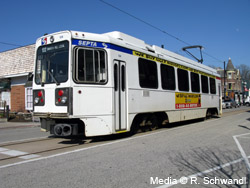
[D]
Media - Sharon Hill Line
|
|
|
|
(formerly known as) Red Arrow Lines, or routes 101 to Media and 102 to Sharon Hill, are two trolley lines which run mostly on a separate right-of-way, and partly on-street (especially line 101 on its last stretch through Media). The two routes share the first 3.4 km along Garrett Road to Drexel Hill Junction, from where line 101 continues for approx. 10 km to Media, and line 102 for 5 km to Sharon Hill.
|
|
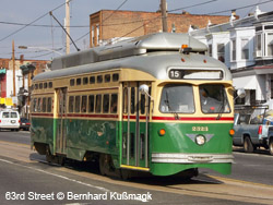
[G]
Route 15 Trolley
|
|
|
|
Trolley
Line #15 |
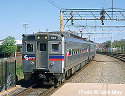
| Suburban Rail | |
|
|
The regional rail system in Philadelphia is truly unique by North-American standards. It features a central city tunnel with all the regional routes going through the city center instead of the typical terminal stations like New York Grand Central and Washington Union Station), and is completely electrified. Some 50 Regional Rail stations lie within the Philadelphia city boundaries. Market East station was renamed Jefferson station in Sept 2014. View a track map of the 30th Street junction (main tracks only; without rapid transit tracks) created by Yuri Popov. |
|
Links
|
|
|
SEPTA - Official Page PATCO - Official Page Philadelphia Transit (at nycsubway.org) SEPTA at Wikipedia Track map of the 30th Street junction created by Yuri Popov Philadelphia Trolley Tracks by Mike Szilagyi Camden-Glassboro Light Rail Project
|
SUBWAYS
& LIGHT RAIL Click here for more info! |
|
|
|
2007 © Robert Schwandl (UrbanRail.Net)