| METRO |
|
Panamá (820,000 inh.; 1.2 million in metropolitan area) is the capital of the Republic of Panamá. |
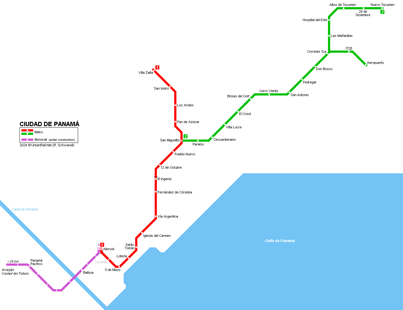
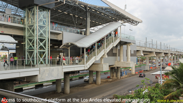
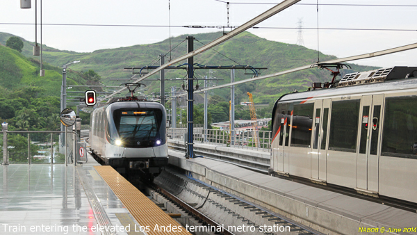
| Line 1 :: Los Andes - Albrook |
|
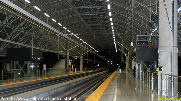
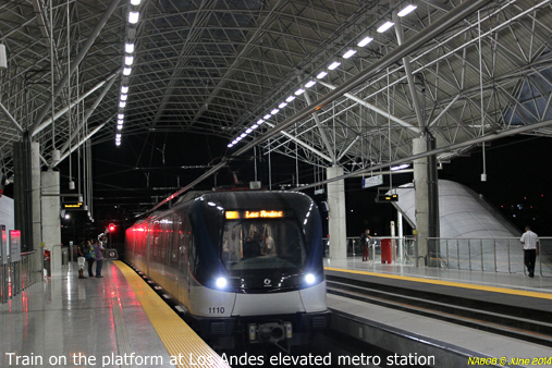
North-south line (18.1 km, 15 stations); 7.2 km underground through city centre, section through northern part of the city is elevated. Construction started in March 2011, and the line was put into service only three years later: 05 Apr
2014: Los Andes - Albrook (13.7 km) |
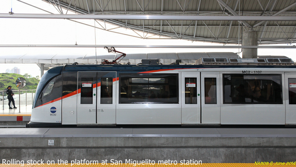
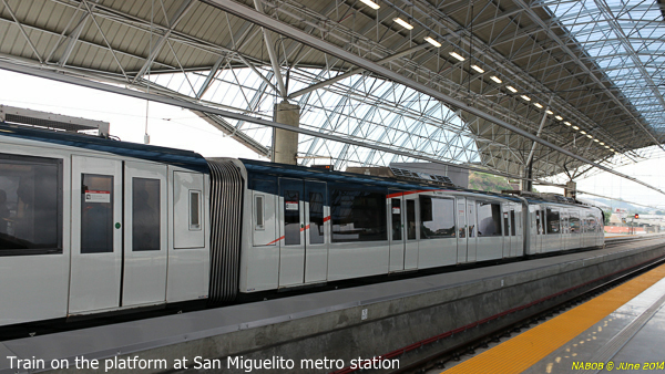
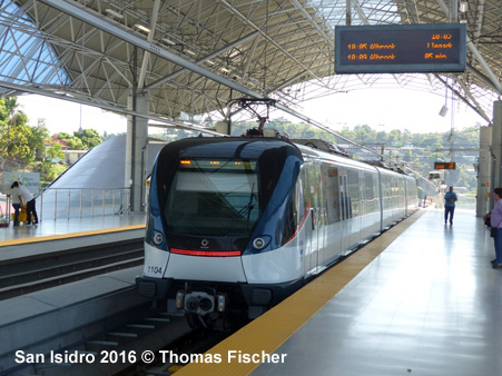
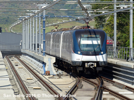
| Line 2 :: San Miguelito - Nuevo Tocumen |
|
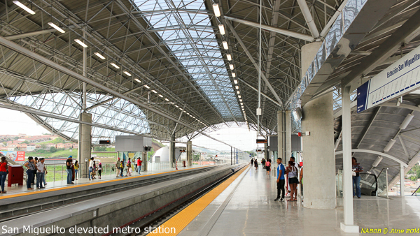
Line 2 initially runs east/northeast from San Miguelito to 24 de Diciembre and Nuevo Tocumen, 22 km, 16 stations; construction started in 2015 for completion in 2019: Partial service operated during 'Jornada Mundial de la Juventud' from 18 to 28 Jan 2019, serving five stations: San Miguelito, Cincuentenario, San Antonio, Pedregal and Corredor Sur. 25 Apr
2019: San Miguelito - Nuevo Tocumen (22 km) |
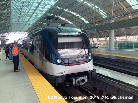
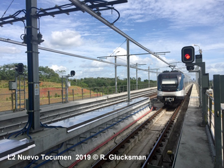
| Photos |
|
|
| Projects |
|
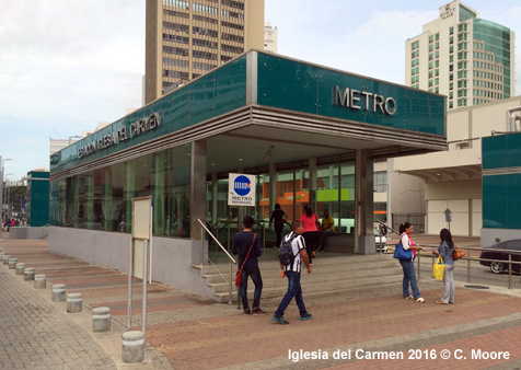
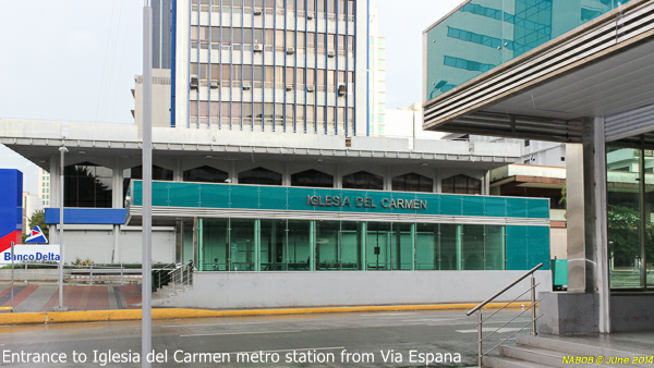
Line 2: In a later stage it will be extended southwest from San Miguelito, then intersect with L1 at Iglesia del Carmen before continuing east along Calle 50 to Multiplaza. Line 3: Monorail line under construction to link the suburbs to the west of the Panamá Canal.
|
| Links |
|
Metro de Panamá (Oficial Site) Metro de Panamá at Wikipedia
|
| Panamá Impressions |
|
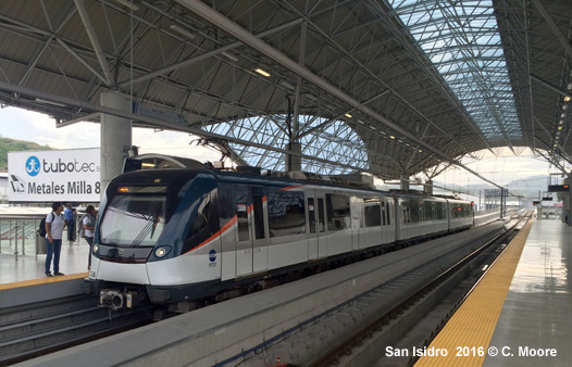
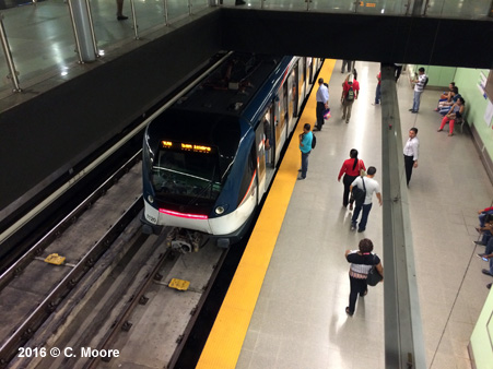
In May 2016, Craig Moore reports from Panamá: The Metro de Panamá is the only Metro in Central America (they exclude Mexico from this geographic reference), its single route covering the traditional city centre in the west and the suburbs to the north-east area of San Miguelito and beyond. The line is 15.8km in length and the journey takes 26mins. The line runs on overhead power supply and uses standard gauge. - Underground
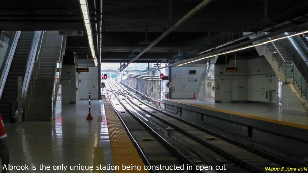
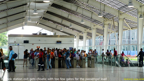
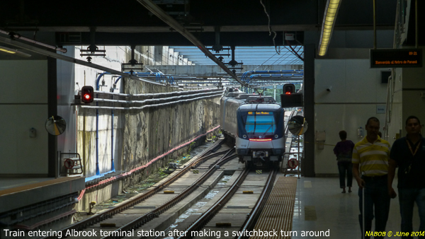
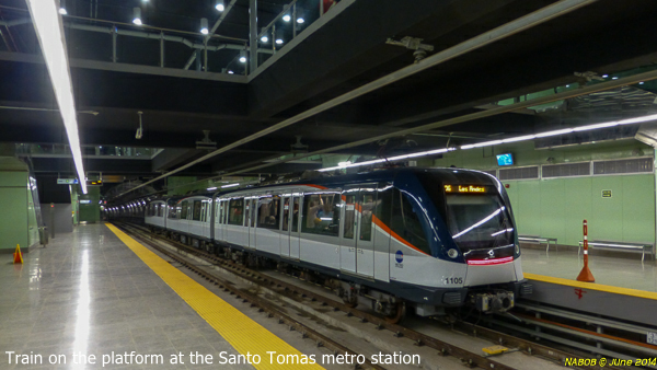
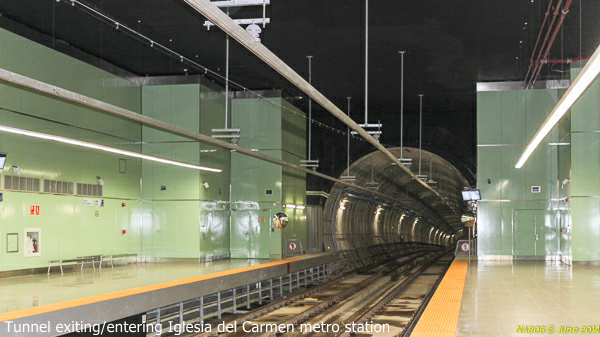
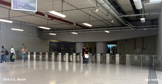
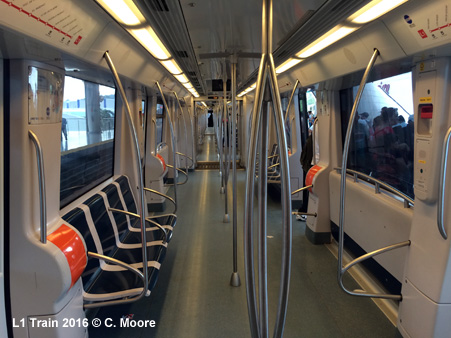
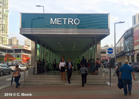
section The underground stations are pleasant and functional. At the street level entrance, stairs are housed under smart dark-green and glass paneled entrances, embossed with large silver protruding letters offering the station name. There is also a derisory totem, consisting of a large disc with logo atop a rusting pole. Nonetheless, the stations present a smart and high quality image in otherwise chaotic streetscapes. The ticket halls are sizeable and clean with an information office (no hard copy information) and 3 or 4 ticket machines at each entrance. These machines are very basic and difficult to use. The system requires you to purchase a rechargeable card ($3) and then add credit through the machines (minimum $1). Cards are then scanned/tapped on entry and exit, with each journey being charged a flat fare of $0.35. I witnessed constant queues at the machines, as I did at the ticket barriers. At the main stations, the Metro simply spews out too many passengers for the barriers to handle and there are regular queues which hardly end before the next train arrives. Escalators, stairs and a central lift lead to the mezzanine and platform levels. The stations have good directional signage easing navigation to the platforms (all side platforms).These platforms are built for 5 car sets and so passengers bunch at one end where the three car sets stop. At the platform level the station interior walls are clad in large pale green panels which are bereft of advertising and look quite stark. There are perfunctory schematic maps, a station location map, a basic strip map with current station shown as a red dot, and direction sign. This takes precedence over the sign for the actual station name which is small and inconspicuously placed. Next train indicators show the next 2 trains with their 4min headway. There is no timetable information or first/last train times (0500-2200) but timetables are not really required for such an intense service level. This is certainly a turn up and go system - passengers hang around the platforms for the next train if they cant face the crush and there is no running if there is a train on the platform a quite leisurely and healthy approach. As the tunnel was bored at a 10m diameter to house both tracks, the views down the well-lit tunnel and across the wide platforms gives a very bright and spacious feel to the platform areas. Indeed, the width and lighting of the tunnels afford great views of the trains arriving and departing for some considerable distance. - Elevated
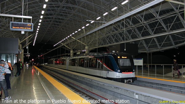
section (6 stations) - Trains
Although I wasn't expecting too much, this is a very effective and efficient system. Trains stop at stations for about 15 seconds, passengers board and alight very efficiently, and with trains every four minutes, a clean environment and good station organisation, this is not a bad little system. |
| Video |


2010 © UrbanRail.Net by Robert Schwandl